Showing posts with label hike. Show all posts

Monday, July 21, 2025

GC16 - Day 4 of last year's August road trip.

This is a continuation of a series of entries detailing my trip to Oregon from last August. First off know that this is going to be about geocaching, so if you're not interested, then please feel free to skip this. 

The main part of this road trip was to get GC16 and GC17, which are some of the oldest geocaches in Oregon, having been hidden back in June 2000 and July 2000. I wanted to find these two caches because they would fill in my Jasmer calendar. The Jasmer calendar is finding a cache that was hidden in every month since geocaching started in May 2000. Because some of these older caches are close to 25 years old, they are getting fewer and far between. In fact, there are only 4 caches left in the entire world that were hidden in August 2000 - one in Utah (which I have found), one in Michigan, one in Georgia and one in Sweden I believe. And the one in Michigan is threatened because logging increasingly gets closer to where it's hidden.

Most of these older caches usually involve hikes and this one was no exception. Google maps was a lifesaver. I had intel about where to park for GC16, so I inputted that and away I went. I literally couldn't tell you how I got there outside of Google took me right where I needed to go. Once there, I parked the car, loaded up the daypack and headed up the trail. I ended up finding a couple of other caches on the way up to GC16 and after finding those, I kept going up the trail and finally found a side trail that I was looking for that would take me to this venerable cache.

The path was narrow on both sides with ferns and they had a lot of water on them, so by the time I was done getting to the cache, my pants were pretty much soaked, but as you can see from my expression, I really didn't care, because I'd marked off another month on my Jasmer calendar and only had to find a cache hidden in July 2000 to fully complete the calendar. That would happen tomorrow. 

As far as the actual cache was concerned, it was a fairly easy find, but then again, most caches hidden back then were fairly easy. It was the experience of the hike, getting out in nature that were the important things. People hid a cache on "their" trail and geocaching was the way people got to explore other trails in their area that they might not be familiar with and this one was no exception. You can see by the size of the lid that it was a rather large container and it was just hidden down in a tree stump. Most people hiking on that particular trail wouldn't even give this particular stump, or that side trail the time of day because the trail didn't lead anywhere, the stump was just a stump. But to me there was something special there, something that I wanted to find.

After signing the log sheet, I replaced the cache as I had found it and then started my half mile trek back down the trail to my car where further geocaching adventures awaited me later in the day. I'll write about those in a later post.


Sunday, April 28, 2024

Bonelli Park Hike

About a week and a half ago I decided to hike the perimeter of Bonelli Park, a regional park located in my area. I decided to take advantage of the nice weather and the fact that there's free parking on the weekdays until the end of April there. There are several different trails that could have lured me in and I've hiked many of them in the past, but I decided to take the main trail around the park, the Bonelli Trail. I'd never hike the entire trail before, so some of this was going to be brand new to me. This particular trail follows fire roads around the edges of the park and sometimes the "communing with nature" is just a myth since the park borders on two major freeways in our area, Interstate 10 running east/west and Hwy 57 which runs north/south. But it was an enjoyable hike nonetheless.

I found a place to park the car down by the picnic area mainly because the trail comes very close to that point and then I started my hike there. It was here that I made my first mistake, but I really didn't think much of it until later in the day. I started out heading in a counter-clockwise direction on the trail, got about 100 yards up the trail when I realized that I hadn't turned on my Relive App on my phone. I wanted to record the entire hike as I traversed around the park. So I walked back down to the trailhead, started up the app and then decided to hike the other way along the trail in a clockwise direction around the park.

The trail from that point works its way over to the west entrance of the park and parallels Hwy 57 for a good distance. But as you can see from the first photo, there's a lot of cool, green and shady spots along the trail. In fact, most of the trail on the western side and the northern side have a lot of spots where you're hiking in the shade of large trees. You also have to be aware of poison oak as well. If you look at the bridge, the bushes growing through on the right side and then again on the left side at the other end of the bridge are all poison oak. It's not something that you'd want to bump into, but as I was walking by, I could tell that numerous bike riders had done just that, based upon some broken branches along the edges of poison oak that encroached on the trail.

On a side note, my back yard rain gauge has measured out over 23 inches of rain since January 1st of this year. Since we average 13 inches or so for an entire year, the lake that lies in the center of the park is very full. I crossed over the spillway for the dam and while no water was flowing at that time, you could tell, just by the dampness in the area that they appeared to be periodically spilling water as the snow melts in the mountains.

Needless to say, there was a lot of muddy areas of the trail, but once I got over on the east side and started heading south on the trail, it dried up considerably with the exception of this one area where I was forced to wade across this water inlet. I took my shoes and socks off and carefully waded in. The water came up almost to my knees, but it was actually rather refreshing. Getting to the other side, I put my socks and shoes back on, had a snack and then continued on with my hike.

The last several miles of the hike, which headed south and then west back to the trailhead where I started were on exposed ridges and/or low lying area with little any shelter from the sun. When I mentioned my mistake before, this was it. Had I done the hike in a counter-clockwise direction, I would have been through this part of the hike early in the day, when the sun is usually very welcome. However, later in the day, it just beat down on me and sapped my strength so my pace was much slower than usual. 

No rattlesnakes were spotted on the hike that day, although it appeared as if the weather was perfect for snakes to be out basking. I did encounter a very large gopher snake just relaxing at the side of the trail. It let me get quite close to it for a photo op and never did try to flee. I also saw a coyote ambling down the trail earlier in the hike, but just briefly, so I wasn't able to get a shot of it before it ambled off the trail and into the underbrush.

Overall, the hike was 9.1 miles with 1276 feet of elevation gain. It took me 3 and a half hours to traverse. That's a decent 2.5 miles per hour for the entire trek. I did end up stopping once for a maintenance check on one of my geocaches hidden in the park, but that probably added only about 5 extra minutes on to the entire hike. It was a good workout and one that I will probably do again, although not until the fall because the weather is heating up and it's harder to hike when it's really hot. And so it goes.

Monday, January 29, 2024

Checking on Caches

Today, I went on a hike up in the Claremont Wilderness Park. It was the first 5 mile hike doing one of the loops in several months and it really felt good to get out on the "trail." You'll notice I put the word trail in quotes. Park of the trail, as you can see here is a maintenance road leading up to a microwave tower on the hill overlooking this part of the wilderness park. When I hike, I always come up that way as it's pretty slippery and I'd rather slip going uphill as opposed to downhill. I very rarely take that particular trail downhill for that reason.

Anyway, part of the purpose, besides just getting out and enjoying the 75 degree January weather we're having, was to check on some of my caches along the trail since I hadn't been up this way in awhile. I'm happy to report that the ones that I checked on, all were right where they should be. 

I used to always worry about cache maintenance a lot and didn't have many cache hides, because I felt that if I had a lot of cache hides, then all my time would be taken up in cache maintenance and not cache finding. But over the years, I've gotten a different attitude regarding caches. First, you don't have to check on all of them all of the time. Second, pick an area and just check on the ones in that area. It works for me now and I'm still able to maintain a good balance between the two aspects of geocaching.

After checking on the caches along this part of the trail, I then headed into the interior of the park. Most of the hard part, the uphill slog along that slippery road was done and the rest of the hike was predominantly downhill on good dirt fire roads. I got to enjoy the views and the good weather. 

As I started working my way down the other side of the canyon, I descended into one of my favorite parts of the trail. It follows a stream that is intermittently wet and dry depending upon the season. There's lots of sycamore trees lining the creek bank which means it's usually cool, green and shady in the summertime, but today I could see lots of sky since the sycamores have dropped their leaves. I've also encountered several snakes and other wildlife in this section, but saw none today. Even the lizards which seem to be everywhere were only venturing out in the really sunny areas and this part wasn't sunny because of the lateness of the day.

I noticed some of the first weedy plants were starting to grow in this area too. I was particularly intrigued by the patterns on the leaves of this plant. I'm not sure what kind it is and I'm sure I wouldn't want to bushwhack through it. Look closely and you can see some nasty spikes on the end of each lobe of the leaves of this thing. Whatever it is, it definitely wants to protect itself, although, I seriously doubt it would stand a chance against a deer if they wanted to partake in eating it.

With more rain expected in the area in the next 10 days, the next time I get up on that part of the trail, the growth will be substantially lusher and taller. That's perfect, in my estimation.

Monday, March 14, 2022

Warm Weather Means.....

Today's post is more of a public service announcement, both to you as a reader and to myself, as I've found I've gotten into some bad habits on the trail that need to be corrected now, before the warmer weather really sets in. I was out on a hike today and I literally almost stepped on this guy. As you can see, he's already been in at least one scuffle in his lifetime as he's clearly lost his tail at some point in order to escape getting eaten. Last thing he needs is to be out sunning himself and have some idiot hiker almost step on him because said hiker is too absorbed in his phone. Yeah, that would be me.

As the weather warms up, all sorts of critters are out and about again. I haven't seen a snake since last November, but that doesn't mean they're not out there, it just means I haven't seen one yet. My mindset has always been, if the lizards are active, so are the snakes. So, needless to say, this was a wake up call for me to start scanning the trail in front of me for possible hazards. Just as in driving, the phone can wait, and besides, why do I need to be looking at my phone when I'm out communing with nature?

The second thing I've noticed is an abundance of flowers starting to bloom and lots of new growth along the trail. At this point, almost all of the poison oak has started to sprout again and there's plenty of areas where it's beginning to encroach on the trail and other areas. I had to archive one of my recent geocaches that I hid, because I didn't notice the beginnings of poison oak starting to grow near where I hid the cache. Now the area is overgrown with poison oak and I don't really want other cachers to get poison oak, so I removed the cache. "Leaves of three, let it be."

Because a lot of people don't know what poison oak looks like, I tend to avoid any and all dogs on the trail during this time. It kills me, because I'm such a dog lover, but if their owners don't know what poison oak looks like, then they're probably allowing their dogs to brush up against the stuff. It doesn't hurt the dog, but the oils will get all over the fur of the dog. If you pet a dog on the trail, all of that oil is just going to get on your hands and now you have poison oak. I've had it once and trust me, you don't want to get it as the rash is pretty painful.

And one last thing. Warmer weather also brings more people to the trail. Just like in driving, stay to the right when ever possible and yield to the uphill climber. Going downhill you have all the momentum with you and you can get it back again very easily, but uphill hikers need that momentum and it takes more energy to stop and then start moving against gravity. I guess the key thing is to be courteous. We need more of that in the world anyway.

Wednesday, September 1, 2021

Adventures

The theme for P.J.'s photo blog for this month is Adventures, and it couldn't have come at a better time, since I went on quite an adventure this past month, though not exactly as planned. But then again, that's kind of the point of an adventure in that you never know how it's really going turn out until after it's done. So here's my five photos from last month, four of which are part of my backpacking adventure and one is of something different.

1. Two striped garter snake

For those of you who have been following along, I've gotten the reputation as the snake whisperer. For whatever reason, I seem to attract snakes to me. I prefer to think that it's because I'm more observant when out walking in the wild, but that's another story that would take too long to tell here. Either way, people say it could be quite the adventure hiking with me. 

My friend Greg and I were on several training hikes up in the Lake Arrowhead and Big Bear Lake area of our local mountains. In Lake Arrowhead, we spotted a Southern Pacific rattlesnake attempting to cross the road. Fortunately, after our car straddled it on the highway, it had the sense to go back to the side of the road and I was able to get a nice video of it as it slithered into the bushes.

This garter snake, a type I've never encountered before, was stretched across the Pacific Crest Trail (PCT) when I spotted it. I was pretty content just to lay across the trail while I took some video and photos of it. I estimate it to be about 4 feet long or so, on the large side for garter snakes, but I guess it was enjoying a bountiful time eating some of the rodents out in the wild. We walked around it, I decided to take another photo from the other side, but never got the photo because I accidentally kicked a rock in the direction of the snake and it took off.

2 - 5. The big adventure

We'd hoped that the training hikes at altitude would have prepared us better for the trek ahead, but we miscalculated a little bit. This is the beginning of our hike which was supposed to be a 23 mile loop through the Cottonwood Lakes region, over New Army Pass and into Sequoia National Park. Following that, we were then going to head south on the PCT and then catch the Cottonwood Pass trail back down to our base camp near Horseshoe Meadows. We spent the first night at Horseshoe Meadows, which is slightly over 10,000 feet in elevation and then began the hike the next day.

As you can see, it looks like I'm pretty excited to head out on the trail and I'm not going to lie, I was. The adrenaline had kicked in and my pace was way too fast for the first 100 yards or so. Fortunately, my shortness of breath told me I needed to slow down, which I did and we progressed at a much more reasonable pace for the rest of the trip.

However, what you're not seeing in the first photograph is my migraine headache. Most of my migraines are caused by stress and usually when the stress is released, is when I suffer the headaches. I can't begin to tell you how many times I've had a migraine on the first day of Christmas break, the first day of Spring break and the first day of Summer vacation when I was teaching. This hike was no exception. I was stressed. As I noted in my last blog entry, this was the first time I'd been backpacking since I was 19, the week that Elvis Presley died. You can do the math, but needless to say, it had been a long time since I'd been backpacking and I was overpacked. I had way too much food and the other big thing that was weighing me down was my tent. Couple that extra weight I'm carrying with a migraine that my prescription meds are just barely blunting and it wasn't the most pleasant trip I've ever been on.

Still, we pressed on and slowly the first couple of miles were behind us. We'd entered early on, the Golden Trout Wilderness area and then progressed up the hill until we entered the John Muir Wilderness area. The next day, we were supposed to enter into Sequoia National Park, but we needed to finish out this day first. 

With the headache, at least checked for now, the hiking was a bit easier, but I had no appetite. So that meant the weight of my pack wasn't declining either. I forced down some food knowing that I needed calories in my system, but it took me the better part of an hour to eat an entire Clif Bar. If you've ever backpacked, these are snack bars designed for hiking, very dense, loaded with calories to give you energy. 

I think there was another contributing factor as well, in that we were getting smoke being blown into the area from the French Fire, which was about a hundred miles away or so. The views were rather hazy and you could smell smoke in the are. If you look at photo number 4, you can see the view from our campsite was rather hazy. I'm sure this didn't help since we were also hiking above 10,000 feet.

After setting up camp and finding a geocache at the far end of Muir Lake, we hung out at camp and discussed the next day's hike. This would have taken us up over 12,000 feet in elevation and been the longest mileage day of the hike. Neither of us were feeling really well and we made the decision that we were going to end our adventure early and head back down to Horseshoe Meadows and go home.

Some of you might say that the trip was a disappointment. Not really. I learned some valuable lessons from the trip. While my tent is an awesome tent for car camping when I'm by myself, it's too heavy for a backpacking trip, so I need to look for something that's much lighter to carry on my next trip. And there's the second thing I learned and that even though this trip was very hard, it wasn't something that would turn me off on backpacking forever. I'm looking forward to more adventures like this, perhaps even coming back here next year. 

The third thing I learned was I packed way too much food. A guy in camp told me his bear canister weighed 10 pounds for an 8 day trip. I had a 10 pound canister for a 4 day trip. Yeah, I had way too much food. And so I'll adjust.

When we got back to the car at the end of our up and back overnighter, I told my friend, "Let's remember the good things about this trip." And so I leave you with one last photo that I took that morning. The winds had shifted overnight and blew all of the smoke from the fire down the hill into Owens Valley and we were left with crystal clear views. The sun was rising, just starting to hit the tops of the peaks. The waning gibbous moon was starting to set over the same peak and the scene was magical. This is why I go on adventures like this.

As John Muir stated, "The mountains are calling, and I must go."

Please be sure and check out some other people's interpretation of the same theme on P.J.'s blog.

Thursday, April 29, 2021

Snake Magnet?

Last week, I took this shot of a 3 foot gopher snake. I also got a nice video of it, plus another smaller gopher snake and a ring-necked snake while out on my hike. All in all, I ended up seeing 4 snakes that day and because I've encountered other snakes in the past couple of weeks, I've been dubbed the snake magnet and several people had indicated that they don't want to hike with me because I attract snakes.

Now a little background is probably in order here. I've always been fascinated by snakes and wanted to have one as a pet when I was younger, but because my mother was deathly afraid of snakes, I never could. While teaching, a teaching friend of mine offered up his daughter's snake to me. She had gone off to college and he didn't want to take care of it, so he gave it to me for my science classroom. It was a beautiful corn snake that I had for about 10 years.

Now I encounter snakes in the wild, probably because during warmer months, I ALWAYS scan 10 to 15 feet ahead on the trail. I don't want to step on one, so I think I'm possibly more observant than the average hiker. And here's something else to think about. If you see lizards on the trail, there are snakes active as well, you just haven't discovered them yet. So the question is, would you rather hike with someone who is observant of snakes and spots them from 10 feet off, or would you rather encounter a snake from 10 inches? The choice is yours, but I'm always willing to hike with you.

Monday, November 2, 2020

The Great Outdoors

For those of you who follow me on Facebook, you've already seen this, but I thought this was rather apropos for P.J.'s photo blogging challenge for this week, The Great Outdoors. So yeah, I'm cheating a little bit since this is actually a collection of 10 photos that I took on a hike this past week, but they work for the theme. 

The hike is an extended hike in a park up in the foothills above my house called the Claremont Hills Wilderness Park. It has a nice 5 mile loop that I extended to make it almost 7 miles. The trails up in the foothills intersect at various locations and the first photo is the sign where the parking lot for the park is located. From there, the trail then splits into either Burbank or Cobol Canyon and those two trails meet on the back side up in the hills. I went up the Cobol Canyon side and then extended it into Johnson's Pasture, which is a large portion not really part of the loop, but has several trails that run through. The hike then continues through Johnson's Pasture and back into the neighborhood where I parked my Jeep.

In June of 2019, I wrote for another photo challenge about encountering a bear on this trail near the back side up at a higher elevation. I've encountered a variety of wildlife on this trail, but it was relatively quiet on this hike.

I found a new app called Relive, which takes your data as you walk and then puts into satellite images to give you a 3D video of your hike. This video is the second video I've created. Neither one is perfect. The first one, I forgot about the aspect ratio and so the edges were cut off so you couldn't see the data. This one has all of the photos interspersed on the hike, but I think it breaks up the hike aspect of it too much. I'll be working with this app in the future as I go on more and more hikes now that the weather has finally started to cool down again.

So here's my interpretation of The Great Outdoors. Please stop by the link at the top of the page to see how others interpreted this them for this month.


Tuesday, October 15, 2019

Above and below

My last stop on this last road trip was Great Basin National Park. Located in eastern Nevada, it protects portion of the basin and range territory that comprises most of the central part of Nevada. One of the few glaciers in Nevada is in this park on Mt. Wheeler, which is the highest peak, at over 13,000 feet, contained solely within the state of Nevada. The park, which was created in 1986, expanded the original Lehman Caves National Monument, so there's also underground wonders here.

Nevada's Highway construction crews slowed me down quite a bit on the day I drove down to Great Basin.  I probably lost an hour of time just sitting in the Jeep while road construction happened along my intended route. But, many areas talk about how they have two seasons: Winter and Road Construction. At least I wasn't adversely affected by it.

Once I got into the park, I immediately headed toward the campground, as it's first come first serve and it was late enough that it could be filling up, which is was. I think I was able to snag the next to the last campground site, but it was a nice site in my opinion. There was a small stream flowing through the center of the site, so I pitched my tent on the opposite bank. The water wasn't flowing very strong, but this site wouldn't be very ideal during high water instances, but it suited my needs perfectly for the next two nights.

The next morning, I went for a hike out to Stella Lake and then up to get as close to the glacier on Mt. Wheeler as I could. Since I was up above 10,000 feet, the air was thin, but the trail had lots of hikers on it, all enjoying the beautiful mountain air. Once I got fairly close to the glacier, I took some photos, and tried to remember back to the last time I was here about 15 years previously. That year, my two boys and I hiked a little bit closer than this shot was taken and actually walked on the glacier. I would have had to walk a lot further this year to get to the glacier because it's receded significantly over time. It's estimated that if current conditions continue to prevail, the glacier will be gone in the next 20 years. That's sad to think about.


After getting back from my hike, I then purchased a ticket for an underground tour of Lehman Caves. There are typical formations in this small cave.  Stalactites hold tight to the ceiling, while stalagmites, might reach the ceiling. The cave, however, is most famous for its shield formations. These shields are two disks with a thin layer of water in between them. The water drips along the edges forming the cave formations.  Carlsbad Caverns, in New Mexico has a grand total of 2 shields in the entire cave. Lehman Caves have over 300 shields and it's a tiny cave system compared to Carlsbad Caverns.

The park service is, at the same time, trying to combat White Nose Syndrome, which is a fungal infection that is fatal to bats. It's very contagious and has killed millions of bats in the eastern United States over the past 5 years. It has been identified in California, but no bats have been affected yet in this state, but the fungus has been found on brown bats in the state of Washington.

The rangers were relying on the honor system, but I felt that the people who were entering the caves were abiding by the rules set out. I have been in a cave in Idaho, so I had to disinfect my iPhone since I took it into the cave. I brought a second set of shoes on this camping trip, so I just wore the other shoes for this tour. They had ammonia baths for shoes if you didn't have a second pair to wear in the cave. Soak the soles for five minutes and you'll be okay.

Next week, my plan is to be in Carlsbad Caverns. I know I'm going to have to disinfect my phone again, but since then and now, I've purchased a new pair of shoes, so I'll be good to go for this trip. Hopefully, this infection will not spread much beyond where it is located now.


Monday, September 16, 2019

Potters Pond

This is a geocaching blog, so if you're not into geocaching, you can probably skip this one right now.  But if you enjoy my geocaching rambles, then you'll probably want to continue reading.

Following my night of camping at Cedar Breaks National Monument, I headed to Potters Pond in central Utah.  Most of you who are into geocaching know that there are challenge caches out there for all sorts of things.  Some are silly and others are rather challenging, for want of a better word.

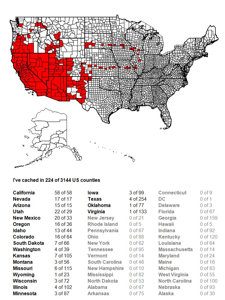
Challenge caches are just that; they challenge you to do something in order to claim the find on the challenge cache.  They can be as simple as find 25 geocaches, to finding a geocache that was hidden in every month since geocaching has been around, to all sorts of other options in between. I worked toward three different challenges on the second day as I drove to Potters Pond.  One was for 100 contiguous county finds.  Before this day, I'd found geocaches in 95 contiguous counties, so obviously, I needed 5 more counties connected to the ones I'd already found geocaches in to get me to 100.  By the end of the day, I'd be up to slightly over 100, so mission accomplished and by the end of the trip, I'd be up to 117 contiguous counties.

The second challenge I was working on was to find more caches above 8000 feet. This particular challenge, I haven't found yet, but it's on my "to do" list.  It's located up in the Sierra Nevada, above 8000 feet obviously, but it would also mean a hike along the Pacific Crest Trail, something that I want to do more of anyway.  It's on the back burner, but as long as I'm at altitude, I might as well get as many as possible.  I'm not sure how many I have at the moment, because it's more difficult to check (I'm on a Mac, so I don't have ready access to GSAK, a Windows based program for geocaching), but I found 12, possibly 13 more that were at over 8000 feet, so I added to the list.


The third challenge was getting Potters Pond. For the uninitiated in geocaching, the Jasmer Challenge challenges you to find a geocache that was placed in every month since geocaching started, way back in May 2000.  Yes, this means you have to find a cache that was hidden in May 2000, plus June 2000, etc., all the way to the current month.  Before this trip, I needed 3 more months, June, July and August 2000.  On my road trip two summers ago, I'd found the oldest geocache in the world, Mingo, so May 2000 was covered.  I'm also fortunate, since I started geocaching in March 2001, there were some of those older caches still around.  In fact, my very first cache find was hidden in December 2000, so I've never had to worry about that particular month.

August 2000 has always been kind of problematic, since there are only 3 geocaches in the entire United States that are still around that were hidden in that month, one in upper Michigan, one outside of Atlanta, Georgia and Potters Pond.  Potters Pond is also at altitude and under snow for probably half the year or so, so it's definitely a summertime grab.  So that became the focus of the day.

Potters Pond is located along a trail near a campground.  The tricky part is finding the correct trail.  Once you find the trail, it's a pretty easy maneuver to get back and find the cache.  I did my homework and when I arrived at the campground, I hiked back, found the correct trail, found a couple of other caches along the way, then walked back into the woods and eventually claimed the prize.  The one photo of the actual pond is what I have as proof that I was there, mainly because the mosquitos that day were horrendous.  As long as you kept moving, you were okay, but as soon as you stopped, they descended, as if they were vultures coming across road kill, even biting through my shirt.  Needless to say, I traded travel bugs quickly, signed the log quickly, replaced the cache quickly and got moving again.  But, I now have August 2000 off of my list and I'm only a road trip to northern Oregon away from completing the Jasmer, as there are caches still around up there from June and July 2000.

If you want hints on how to get there, which roads to take, don't hesitate to ask someone who's already found it.  Bushwhacking would take a lot out of you.  The trail leads right to it.  I listened and learned.

Thursday, September 5, 2019

Cedar Breaks

When I started my first road trip of 2019, I knew my first stop would be Cedar Breaks National Monument, located just east of Cedar City, Utah.  There were a couple of reasons for camping here, one that it's usually very uncrowded and so you pretty much have the pick of campgrounds.  A second reasons was there was an earth cache in the park that I wanted to find so I could complete a geocaching challenge of finding an earth cache in four different states on the same day.  As it was, I'd already found an earth cache south of where I was, but camping there still made sense as it was a good jumping off point for my next day's adventures.

I've camped in Cedar Breaks previously and it really is a good jumping off point for various spots around Utah that we have wanted to explore.  For those of you who aren't familiar with Cedar Breaks, I think I can best describe it as a miniature version of Bryce Canyon National Park.  It doesn't attract the visitors that Bryce Canyon does, mainly because there's not nearly as much to do there.  The features in the park are nice, but you can't hike down into them the way you can at Bryce Canyon and that's by far and away the best feature, to be able to hike among them.  And so it becomes more of a jumping off place.  You walk the rim, you look down on the hoodoos below you and then you move on.

But, apparently, the word is out that this is a nice place to visit.  When I got there around 5:30 in the evening, the campground was pretty much filled, so I didn't have a great deal of choice in spot, but I was still able to snag a nice spot for the night.  Once I had camp set up and dinner in my belly, I decided to head out on a hike because I still had plenty of daylight.


Because I've been there previously, I decided to take a trail I hadn't explored before which was the Alpine Pond Trail which led off of the Chessman Ridge Overlook and walked along the eastern edge of the amphitheater of Cedar Breaks, leading to an alpine lake at 10,400 feet of elevation.

It was a pretty much level hike because most of the park where visitors are is all above 10,000 feet, but the air was thin. I probably overdid it a little bit on this hike for a couple of reasons.  One, I was running out of daylight and I wanted to get some good shots while there was still light and two, which is in hindsight, I was a little bit dehydrated after driving all day.  I definitely had not kept up a sufficient amount of fluids in my system that day and I was going to pay for it later with a little bit of altitude sickness.

Another reason I decided to take the trail was also to escape some very loud college students who decided to park themselves out on Chessman Overlook and scream at each other from 3 feet away or so.  Seriously?  You're 3 feet away from each other and you feel the need to scream?  I can already hear my daughter in my head saying, "GET OFF MY LAWN."  It didn't really matter, because I escaped the noise by hiking away from it, and when I came back, they were gone and I had the overlook to myself.

The hike was very peaceful and I had lots of opportunities to see the amphitheater through the trees.  There were lots of wildflowers alongside the trail: Scarlet paintbrush, Colorado Columbine and Shootingstar being the most abundant that I saw.  The trail followed a creek that flowed down into the breaks and eventually led to the pond. I followed that creek to the alpine pond where I was rewarded with some very nice reflections of the sun glowing off of the trees along the opposite bank.  I lingered there taking several different photos with different exposures hoping that one of them would turn out decently, then decided to take the same trail back to the overlook which was a very good decision.


Had I taken the trail in a loop instead of an up and back, I would have missed the sunset on the rim. After enjoying the sunset and taking a multitude of shots, I drove back to my campground and settled down for the night, hoping to have a restful night sleep.  Unfortunately, the high altitude did me in that night and I didn't sleep very well due to headache and upset stomach.  Fortunately, fluids and food the next morning, plus a drop in elevation leaving the monument helped me recover rapidly. In the past, I've always slept well at Cedar Breaks and the only thing I can attribute all of this too was my intake of fluids during the drive up there from Southern California.  I didn't have any problem the rest of the trip, even though I was at altitude for most of the trip.  I made sure I was properly hydrated and was probably acclimated to the altitude as well.

In the morning, I walked along the rim, taking photographs, checking out the visitors center when it opened and just enjoying the sights the park had to offer before I hit the road again.  I could hear Utah's oldest geocache calling my name.

To be continued.....

Sunday, September 1, 2019

The Written Word

August has been a very enjoyable month.  For the first time in 20 years or so, I didn't go back to work in August.  Yeah, school used to start in September, but it's been opening up in August for quite a number of years.  In fact, today is my youngest's 24th birthday.  His due date was September 12th.  I was concerned at the time, because that was the first day of school for me.  Now, school begins the first week in August.  But as many of my friends know, it's not my circus, not my monkeys anymore because I retired at the end of the last school year in May.

P.J. has his monthly blog challenge and this month's challenge, for the month of August was The Written Word.  At first, I thought I wouldn't be able to put anything together, photographically for this particular month, but when I look back over my photos I took this month, I realized that I have quite a selection from which to choose.  And so it goes.

August, as noted above, was very different this year.  I actually spent time in five different states, so I've decided that each photo this month, not only should convey the theme of the written word, but should also represent each one of the different states that I spent time in this month.  I've posted on Facebook photos of signs leading into National Park sites that I visited and said, "I'm a National Park Geek."  And someone joshingly pointed out that maybe I was a sign geek.  Well, that's possible.  I love how signs sometimes give you so much information with very little words.

1.  Hiking
I like to hike, always have, always will.  I spent the month hiking a lot.  In fact, I spent a large portion of the summer hiking. One of my favorite hikes is a 5 mile loop in the Claremont Wilderness Park, a park that I didn't know even existed back in 2001.  That was the park that started me on geocaching, mainly because when I discovered geocaching, this park was where the closest geocache was hidden from my house at the time.  It was literally 7 miles away and a half mile hike.  I bought a GPS, took the boys out that Saturday and we found the cache.  We didn't walk the entire loop that time and there have been many times in the past I have not hiked the loop, mainly because I was out of shape at the time.  I'm not sure I'm in great shape now, but I do know that I'm in much better shape than I was back in 2001.  This is a good thing because I want to enjoy my retirement for as long as possible and being in good shape will help me achieve this goal.  So the written word on the sign post either tells me how far I've gone, or how far I still need to go to complete the loop.  In this case, I took it after I'd already hiked 4 and a half miles.  This was taken in California.


2.  Road trip
In the middle of the month, I took a week-long road trip through four states, just so I could feel that my routine was a little bit different for this month as opposed to most Augusts over the past years.  I grabbed Interstate 15 and took it north, traveling through Nevada and then into Arizona where the second photo was taken.  I love the color in this photo and amount of information.  
At least 7 different signs tell you a bunch of information that you need to know as you barrel your way into Arizona at 75 mph.  And no, I didn't take this photo while flying down the Interstate.  I actually did pull over and take the shot, although now that I look at it, I wonder if that would be considered emergency parking?

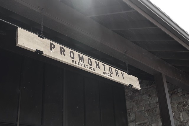
3.  The Golden Spike
That first day, I eventually ended up in Utah.  A couple of days later, I decided that my next point of destination would be Golden Spike National Historic Site, the site where the trans-continental railroad joined the country together in May, 1869.  The country would never be the same.  Promontory, Utah was a boom town, which grew up at the site of the Golden Spike, but soon died when the railroads moved operations to a more profitable route.  I spent time time at the site watching the engines move up and down the tracks and I also got a nice hike in along the old railroad rights of way.  I say ways, because the two railroad companies literally created grades for the two lines that went by each other for 230 miles or so, mainly because they hadn't agreed upon a meeting place and they were getting paid by the mile by the United States Government.  When they finally agreed upon a meeting place that at Promontory, the grading stopped and they worked toward that point.  I also learned that the original golden spike is nowhere near Utah anymore.  
Because the Union Pacific Railroad abandoned these lines first, the Central Pacific ended up taking over this part of the rail lines and so ended up in possession of the golden spike, which is now located at Stanford University.  I guess I need to go to Stanford to complete this trip.

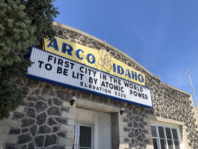
4. Atomic Power
After Golden Spike, I ended up in Idaho for my next adventure.  I was going to be camping at Craters of the Moon National Monument. Taking back roads to the northeast of the monument, I ended up driving through the small town of Arco, Idaho. Now, when you think of Idaho, do you think of atomic power?  Probably not and although I was peripherally aware of Idaho's contribution to atomic power, I was not aware that Arco was the first city lit by electricity via atomic power, something that the town, obviously, is very proud of. This is one of the reasons I love road trips like this.  You stumble upon all sorts of interesting tidbits of information that you might have missed if you just flew into an area with one destination in mind. 

5. Extra Terrestrials
After camping at Craters of the Moon and also Great Basin National Park, I decided to come home. But, as a geocacher, I had to stop here.  This last shot I found at a gift shop at the beginning of the E.T. Highway which runs along SR-375 in Nevada just east of Hwy 93. It's become somewhat of a Mecca for geocachers around the world, because it's one of the major "Power Trails" in existence.  A power trail is a route set up by geocachers where there are a lot of geocaches along a specific route. Geocaches are not supposed to be closer than 528 feet apart, so a power trail typically has one every 10th of a mile for a long distance, in this case, the E.T. Highway has a geocache hidden every tenth of a mile for 200 miles.  Yeah, the math works out to 2000 geocaches.  I found the first one in the series and then turned around and continued on my way home.  At least now I can say I've geocached on the E.T. Highway.  Whether I ever get back to it or not is an entirely different story.  I have, however, signed a challenge cache near the beginning of the E.T. Highway, which challenges me to find 1000 geocaches in the state of Nevada.  With only 76 finds in the state, I have a ways to go and this power trail would help me complete that challenge.

So that completes my interpretation of P.J.'s month blog challenge, the Written Word.  Please click on the link and check out other bloggers' interpretations of the theme for this month.

Sunday, August 25, 2019

The Suburban Jungle

Just because you happen to live in suburbia and are hiking/walking on a paved trail, does not mean you need not be watchful of your surroundings.

As I came down the Thompson Creek Trail this morning, about halfway through my morning walk, I spotted a gathering of people, all of whom had their phones out.  Gotta be an unusual animal of some kind.  

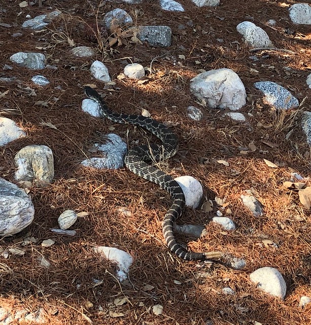
Yep.  Just your average Southern Pacific Rattlesnake slithering from one little haven to another, across a cement bridge and then over to another spot where it could hand out for the duration of the day that was promising to get nice and hot.

Here's a link to a YouTube video that I took right after I took this still shot.  The agave plant where the snake eventually took refuge is literally up against someone's back yard wrought iron fence.

Tuesday, August 6, 2019

A New Normalcy

Over the course of the year, there is an ebb and flow as the seasons progress throughout the year. Many of us have our ebbs and flows with our job as well. It's at this time of the year that my thoughts usually turn back to my job since the school year is starting throughout most of the country.

This year, however, as most of you are aware, that changed for me because I retired at the end of the last school year. So instead of going to my first day of school, I went on a hike today. That's the first time I haven't been at a first day of school in 36 years. Then, after I got back, my son and I went to the local REI store and I purchased a new hiking shirt, something that would wick the sweat away from my body a little bit better than my T-shirt did today.

Summertime, for me, was always a more leisurely time period. No alarms, unless I set them because I wanted to do something. Getting up a little bit later in the morning and just enjoying each day without having to rush to get things done. Now it seems like the entire year is going to be more like that.

My wife started back on her work day routine this morning, so I woke up when her alarm went off, but didn't immediately get out of bed. During our regular work week, I'd get up first, take a shower and then she'd take a shower, after I "warmed up" the bathroom. Well I didn't do that this morning, but I did eventually get up and made a pot of coffee for us to start the day.

So it's a little bit different now. Next week, instead of creating second week lesson plans for four or five different classes, I'm heading out on a camping trip into Utah, Idaho and Nevada. In October, I have a road trip planned to Denver, because there's a major exhibit of Monet paintings at the Denver Art Museum. It's only there from October to February so when, as a teacher, could I really see something like that? Now I can. 

In September, during the week, I plan on doing an over night trip to Paso Robles to see the Sensorio Paso Robles Field of Light. My hope is that I'll have something like that to do each month. I'm looking forward to new explorations and adventures. That's my new normalcy.

Sunday, July 21, 2019

Yellowstone

This is the 3rd of a series of semi-regular articles chronicling the 2017 road trip my youngest and I took to Wisconsin and back again.  This is something that, after you read this, think to yourself, "don't do Yellowstone in just one day."

The first time I visited Yellowstone National Park, I think I was 12 or 13 and we spent at least a week there.  The second time, I was newly married and my wife and I spent 3 days.  This time around, my youngest and I spent just a day in the park, driving in from Idaho, then driving back out later that evening at dusk.  There is no way, that's nearly enough time for anything, but we packed as much as we could into the day, hiking, sightseeing and geocaching.

We came in through the West Yellowstone entrance and then headed toward the geyser basins.  The first major stop was at the Grand Prismatic Spring seen in the first shot.  This alone is worth a partial day visit.  I wish there was a way I could convey the colors, the smells and everything about this, but I just can't.  This photo is close, but I don't think it does it justice.  And we didn't even get around to the other side.  There's a trail on the hillside that gets you at elevation above the spring so you can see how truly grand it is and how large it is.  That, in and of itself, gives me another reason to go back and spend more time there. It's the largest hot spring in the United States and third largest in the world.  It measures 370 feet in diameter and is 160 feet deep.


After the spring, it was on to the Old Faithful area.  All I can say is check the geyser schedule somewhere ahead of time. We got there at noon, about 10 minutes before eruption and it took us 15 minutes to find a parking spot.  Because we were day tripping in the park, we didn't really have a choice as to when we were going to be there.  Needless to say, we didn't see it erupt that time, but watched it erupt twice more that afternoon, once by the seating areas and once from a trail.  The second time, it was erupting while Beehive geyser was also erupting.  That's pretty spectacular to see two different geysers fairly close to each other erupting at the same time.

The rest of the afternoon, we spent hiking here and there among the geysers, taking in the sights, doing virtual and earth caches.  Earth caches and virtual caches are geocaches that don't have a physical container.  Virtual caches usually take you to a specific place of scenic or cultural beauty and you have to answer a specific question about the spot, or post a photo of you at the spot to prove that you were there.  Earth caches are similar, only the spot is geological in nature and you have to answer geology questions based upon what you see at the spot.  The National Park Service, with a couple of exceptions, doesn't allow physical geocaches in the parks because they view them as litter.  They do allow virtual and earth caches though, so we spent the day doing those.  With all of the stuff we were learning, our brains literally hurt by the end of the day.


While we were there, we watched Old Faithful erupt at around 2:30 or so.  Packed house.  We hiked around some more in the area, then went to nearby restaurant to eat dinner.  Came back out and watched Old Faithful erupt again and could have had our pick of seats in the seating area at that time.  Lesson learned.  If you have time, wait until after dinner to watch Old Faithful erupt.  Most of the crowds have dispersed back to their hotels or campsites and the parking lot has many spaces available.  I don't think it's ever not crowded there, but there were definitely less people later in the evening.  In the summertime, it doesn't really get dark until after nine o'clock, so you have lots of daylight hours in which to work.

After dinner, we drove over the continental divide and drove down to view Yellowstone Lake.  There was another geyser basin right along the lakeshore, so we walked the boardwalks there and enjoyed the peacefulness of the lake.  There were not as many people here, mainly because it was getting later on in the day and as noted above, most people had "gone home" for the day.  After sightseeing lakeside, we hopped back in the Jeep and made our way back through West Yellowstone and into Idaho where we were staying the night. A bison jam slowed us down, but that was pretty cool watching a herd of bison walk across the road in front of us.  At least we weren't going the other way on the road where a bison decided to lay down in the middle of the lane and take a siesta.

Moral of the story is, don't even think about just spending a day there.  I think you need a week, maybe longer to fully enjoy the park.  I know I'm going to be spending some more time there in the future.

Sunday, July 14, 2019

Ice House Canyon

This past week, I went hiking with a friend up Ice House Canyon, which is a popular trailhead out of the Mt. Baldy area.  We were heading up to the Ice House Saddle, a portion of the trail that literally splits into five different trails at that point, leading to other peaks, or down into other valleys on the far side.

We got a fairly early start leaving my house around 8 in the morning and with a quick stop for a sandwich, we were at the trailhead and hiking by 8:30 in the morning.  One of the nice things about this hike is it's mostly in the shade and the temperatures are about 10 degrees cooler than what we'd experience down off the mountain, so we were hiking in the morning in about 50 degree weather.

At one point we ran into a spot where an entire boulder next to the trail was covered in ladybugs.  I've seen other areas further up and on the other side in the Lytle Creek area where I've seen the same kind of thing and it never ceases to amaze me.  Just thousands upon thousands of ladybugs.

The hike itself was very enjoyable, albeit steep.  2700 feet of elevation gain in about 3.6 miles.  I'd never hiked up to the saddle before, but I have been up on that trail several times, the last time was about a year and a half ago.

I knew my friend liked this particular hike and he kept commenting about different things on the trail to the point like he really knew all the twists and turns of the trail.  I asked him when he'd been on the trail last and his response made me laugh.  Yesterday.  Ok, that's why you're so familiar with it.

Getting up to the saddle took us a little over 2 hours and by that time, even though it was before 11 in the morning, it was time for our sandwiches.  So we found a log with the view posted here and enjoyed our lunch before we headed back down.

I will have to admit that the trail was about as slow going down too, mainly because the upper part of the trail was the only part that really resembled a simple dirt trail. Most of the trail was rocky, stair step type of trail where you have to go slowly so you don't lose your step or your balance.  It still was enjoyable, but we didn't make as good of time as would be expected since we were headed downhill.

I didn't find any geocaches along the hike, but that was not the purpose of the day.  We passed three on a side trail that I hadn't found and there were three more further up the trail from the saddle that I will have to wait for another day in which to find those.  I showed my friend one of the geocaches that I helped hide the last time I was up there.  In fact, that particular cache was named because of all the ladybugs that were in the area at that time.

I'm definitely going back, perhaps next week.  I hear some geocaches calling my name and there's also spots along the upper portion of the trail where new caches could be hidden.  I think the most surprising thing about the trail was the total lack of poison oak.  We didn't notice even one plant on our entire hike and we were in spots where you'd definitely expect to see it.  Curiouser and curiouser.

Thursday, July 4, 2019

Forgetting about things

Most of you know know that I enjoy hiking.  Yeah, tell us something else we don't already know.  Anyway....  I was looking through my Fitbit app on my phone and noticed some "workouts" I'd done.  I was thinking that I don't remember recording anything from June 19th and then it dawned on me that these were hikes that I'd done two years ago.

Now, everything made sense.  So I decided to keep track of my latest hike with the app and see what the map looked liked.  The weather was overcast this morning, which made it perfect for a more strenuous kind of hike, so I got the gear I needed and drove the Jeep over to the neighborhood where I could access the Thompson Creek walking trail.  From there, I accessed the trail/fireroad which took me up into Johnson's Pasture.  If you're following along at home, I'm moving on the map in a clockwise direction.

That trail eventually took me over to the Claremont Hills Wilderness Loop trail and I just kept going from there.  At the very top of the map is approximately where I encountered the bear that I wrote about in this post.  At about that time, it's pretty much downhill so my pace picked up.  At the top of the loop, I was averaging about 22 minutes per mile, so you can see that I picked it up on the downhill side so that I was averaging over 3 miles per hour.  

Another place in the app, I can access how much elevation gain this hike was and it was about 1200 feet of elevation gain overall. Not really that tough since that's a 7 mile hike, but compress that 1200 miles down to the first 3 and a half miles and it's a little bit more impressive.  Either way, I fell I'm doing much better on my hiking stamina than I was in the past.  I'm hoping for some more cooler mornings so I can get out again before the summer heat really takes over. Now I just need to remember to record my hikes into the app.

Happy 4th to everyone.  Be safe.

Sunday, June 30, 2019

PHOTO BLOGGING CHALLENGE (JUNE 2019): GET OUT AND PLAY

So I haven't done this in a couple of years, but since I have a new blog, I thought I'd get back into this again.  The theme was relatively easy to cover this month, since it was pretty much in my wheelhouse considering the circumstances in my life at the moment.  This month's theme was "Get Out and Play" and I did that a lot this past month.


1. Foggy morning

For readers of my other blog that haven't come over here yet, I retired at the end of May after teaching for 36 years.  I can really get out and play all the time now.  This particular photo was taken on Monday, June 3rd, the first day of my summer vacation since I don't technically retire until August 1st. The fog is actually the key to this photo.  This is a fire road loop trail in the foothills north of the town I live in in California.  This is the sunny side of the trail.  Coming down the other side you descend into a creek ravine and there's lots of trees there, so I usually just do the loop counter clockwise so I can finish in shade.  I didn't need to do that this time, but I'm really glad I did.  Hiking is one of my passions and I'm trying to build up stamina even more for longer hikes in the future. This, being the first hike of the summer, was a short hike by my standards.  But at the 2 and a half mile marker, I came upon a bear walking up a side trail.  For those of you who are familiar with this loop, this is really close to civilization, but there he was, a bear on my first day of vacation.  And, no, I was too interested in watching it that I didn't even get any photos of it.  By the time I thought about taking a shot, it was up on the ridge above the main trail, in heavy fog, behind some bushes.  Even if I had taken a photo, it would have been a grey blob.  So, you'll just have to trust me on this one.  Talking with rangers after I came down indicates that they think there's at least 3 bear up in the foothills calling this spot their home.  I've been hiking up there for the better part of 15 years and this is the first time I've seen a bear.  I probably have a better chance of seeing a rattlesnake up there, yet I haven't seen one of those either.  And so it goes.


2. Halfway through

One of my other passions is geocaching, which I do a lot.  Some people would say I'm obsessed about it.  I've been finding caches in the  wild and in the urban environments since 2001, before the hobby/sport/game was even a year old.  The nice thing about geocaching is it usually involves hiking, so I'm all over that.  Or at least getting off of your butt and out in the environment, even if it means just looking around town for things hidden then.  I prefer going out on geocaching excursions with other people.  This particular hike would have been really frustrating since we ended up with a lot of DNFs (Did Not Finds) for the day.  Eh.  That happens.  

As you can also see, I upped my mileage for this one.  Technically, this was a little less strenuous terrain-wise since it was all on paved trail, but it was definitely longer.  This was taken at mile marker 6.5 and we'd actually walked beyond that marker before we turned around and went back down the canyon we in which we were hiking.  I also hide a cache up in the canyon.  Curiously, no one has found it yet.  That is usually a rarity as there are always cachers out there who like to be First to Find on any cache, but since this particular hide is a 4 mile hike one way, it's going to take more than one cache to lure many people out there.  Had I hidden two or three caches out there, all of them might already have been found.  But just one?  I suspect it will sit there until the fall now before someone ventures out to find it.


3. Pacific Crest Trail

When I was younger, I really wanted to hike the entire Pacific Crest Trail.  I still do actually, but life is in the way.  I don't think my wife would take kindly to me taking off for five to six months to be by myself in the woods.  Although today it's probably much safer than it was 40 years ago, it's still a challenge.  The trail is 2650 miles long.  700 of that is hiking pretty much through desert landscapes.  You hike 1700 miles before you even leave California.  It's a rugged trail to say the least.

This doesn't mean I've given up on the idea, it's just on the back burner.  Right now, I've been pretty satisfied just getting out and hiking sections of it, like this one north of Big Bear Lake.  Taking a weekend backpacking trek or possibly a five day trek is not out of the realm of possibilities.  I'm sure my wife would rest easier if I went with someone else.  Any takers?


4. Checkerspot butterfly

Photography, another passion of mine has changed over the years.  I've started an Instagram account called @dogzonwalkz where I literally go out and take photos of dogs on walks and post them to my account.  Feel free to follow along there as well.

I've always enjoyed photography and this month, I went back out and started exploring other areas that I've neglected in the past, particularly, nature photography.  While out on that geocaching hike earlier in the month, we were literally swarmed by flocks of butterflies.  We counted 7 different species of butterflies as we hiked in the canyon. I didn't have my main camera with me because I was trying out some new trekking poles, plus I was geocaching, so I felt that leaving the large camera at home was the right thing to do.  All I had with me was a point and shoot and my iPhone.  This Chalcedon Checkerspot on a berry blossom was taken with my point and shoot.  There was another instance where I had a chance to get a shot of one of the other types of butterflies and I couldn't get close enough to get a shot like this since all access in was through a large patch of poison oak.  Nope, I did not want to go there, which means there's still a place for my larger camera and its big zoom lens.


5.  Muir Woods National Monument

Growing up, my dad would always take the entire family on camping trips and most of those camping trips revolved around seeing some kind of national park in the western United States.  I continued that tradition with my kids and took them to many of the places I'd been to as a kid.  I also took them to new spots, places I'd never visited or camped at previously.  Joshua Tree National Park comes to mind very quickly as one of our spring trips.  Another spring trip was to Organ Pipe Cactus National Monument.

One spot that I never visited, nor took my kids to see was Muir Woods National Monument.  I finally got to visit it when my wife and I went up to visit my daughter and son-in-law last week in the Bay Area.  We had tried to visit it last summer, but didn't realize that you need reservations for parking in the park, or to get a shuttle down to the monument and the place was sold out for the week we were there.  Once we finalized our travel plans this year, I went ahead and booked a parking reservation for the monument and we were good to go.

The park is very peaceful and despite the number of people in the park on the trails, it never felt like it was crowded, nor were the crowds disrespectful of the environment.  Most walked quietly taking in the glory of the coast redwood environment.  If people did talk, most talked in low whispers out of respect for everyone around them.  Other national park places I've been to people haven't shown the same kind of courtesy, which is why I really enjoyed myself while we were hiking along the trails.  My daughter said she enjoyed watching me just enjoy the moment.

And that's that for this month.  I hope you enjoyed these offerings to the Get Out and Play challenge set up by P.J. on his a Lil' HooHaa.  Check out some of the other photographers and how they interpreted the challenge for this month.

I apologize in advance if I don't comment back on any of your comments.  For some reason, I haven't been able to do that and if anyone else who uses Blogger can figure it out and help me out, I would greatly appreciate it.