I still haven't covered all of my road trips from this past summer and fall, nor have I even covered all of my road trip from 2017. And so it goes. With the social distancing now in effect in the country, I have more time to deal with stuff here and not do those frivolous things like hiking and geocaching. Well, I'm still doing the former and practicing social distancing at the same time. But, on to the real subject of this particular blog.
Part of the fun of solo road trips is you can stop where ever you want to stop and explore things that might not happen if you're with other people due to a set agenda. As I was driving between Albuquerque, New Mexico and Flagstaff, Arizona on my October road trip, I spotted signs for El Malpais National Monument. I'd never been there before, so why not stop and visit?
One of the drawbacks to doing something like this however, is if you have somewhat of a set schedule, stops along the way sometimes get short circuited, because you don't have enough time to do a proper visit. This was the case with this particular stop. I basically saw some of the "greatest hits" of the monument, but really didn't get to explore it in depth. Had I had more time, I probably would have spent the night here, camping in the campground and then moved on later the next day, but I didn't have camping gear with me on this trip anyway, so the point was moot.
The park is rich in volcanic activity, with sandstone bluffs sticking out above several different lava floes in the park. There were several earth caches that I worked on during my brief stay in the park, so I learned that there were at least 7 different periods of volcanic activity across the plains as I looked out from the top of the sandstone bluffs. Much like my time at Craters of the Moon National Monument in Idaho this past summer, I could actually see the different floes, because each had a different characteristic and age to it based upon the amount of vegetation that was growing within the floe.
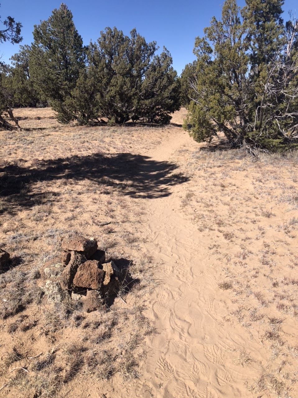
I did a couple of short hikes to viewpoints, at one point hiking along the Continental Divide Trail (CDT), one of the big three trails in the United States that run north to south. The CDT runs from the Mexican border in New Mexico all the way into Glacier National Park in Montana. Because it's a relatively new trail, unlike the Appalachian Trail (AT) or the Pacific Crest Trail (PCT), the route is not as clearly defined. In fact, right here in the monument, there were two possible routes you could choose if you were hiking through the park along the CDT, one which went inland seen in the first photo, or the other which went along the road and was a little bit shorter. Either would count if you were hiking the trail, but if I were backpacking the trail, I think I'd opt for the part that went through the monument as opposed to along the road. In my opinion, road hiking is not that exciting.
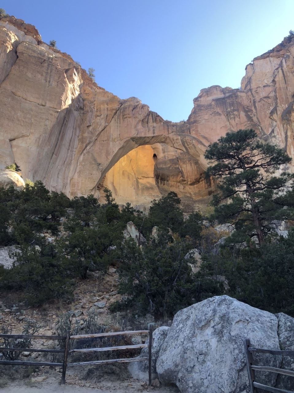
The last thing in the park I explored that day was the La Ventana Arch in the southern part of the park. La Ventana is a natural arch formed due to wind erosion. Looking at the photos I took, it's a little bit difficult to see the arch, unless you see the sunshine on the back part of the sandstone bluff behind the arch. I was there in the morning hours and the sun was not in the right place. I'm sure the view would look differently, were it later in the day and the sun was shining on the arch as opposed to in your face in the morning hours when I was there. Still, I got some pretty cool shots of the arch, one of which I'm using right now as my wallpaper on my desktop computer. Needless to say, I intend to visit the park again if I'm driving along I-40 in New Mexico. At least this time, I'll know what I'm getting into and save some extra time to explore some areas more in depth.
Many people I know who really enjoy our country's national parks, tend to forget about the smaller national monuments. That means the crowds are smaller and there's more space to enjoy the quiet solitude of a particular spot. This is definitely the case here at El Malpais. I'll be back sometime in the future.
Once again, it's the end of the month, which means it's time, once again for P.J.'s monthly blogging challenge. The theme for this month was liquid. I have to be honest with this one. When I first saw the theme at the beginning of the month, I figured there would be no way that I would be able to come up with anything for the theme, let alone five shots. But, once the month got underway, I saw ways that this would work, so bear with me as I think I'm stretching the boundaries a little bit with this theme, but at least I didn't have to resort to any photos of snow. Snow? Yeah, I actually saw it snow in a city for only the second time in my entire life, but that's another story that I'll tell at another time.
I'm actually doing these in chronological order, which means this first shot was taken on October 20th. Yes, I did the entire theme in less than 10 days. At first, I thought that I might get by with 5 different cave photos, because after all, what creates a cave but water? And so I figured I was done, but I'll not post a bunch of photos of the caverns, because after all was said and done, I was able to come up with 5 different liquid shots. And to also be honest here, this blog entry is sort of a teaser for other entries I'll be writing about next month.
1. Phoenix, Arizona
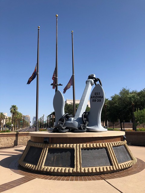
In my last post, I mentioned that I would be on an extended road trip and I just came back from that one Sunday. The main purpose of the trip was a visit to the Denver Art Museum to see a very large collection of Claude Monet paintings. The collection was only going to be there from October to February, so I figured this would be the best time to go to avoid really bad weather. Anyway, the first day of the trip took me through Phoenix. And, as usual, I spent some of the time on the drive geocaching. I ended up in downtown Phoenix, where there is a large war memorial to all of the different wars our country has been involved in. Part of this park is where I discovered the USS Arizona's anchor. Pulled from the liquid depths of Pearl Harbor in Hawaii, this anchor is on permanent display at this park in Phoenix. Around the base of the anchor are all of the names of the brave men who perished on that fateful day in 1941.
2. Guadalupe Mountains National Park
This was a new place I'd never visited before and originally, I had planned on camping here, but things fell through on the opposite end of the trip, so I ended up staying at motels along the way. This was actually a good thing because camping was very limited in this park. The Guadalupes are the extension of Carlsbad Caverns, only above ground. I spent most of the morning exploring the Caverns, and after having thoroughly explored them, I ventured south to this national park, just across the border in Texas. This park is mostly wilderness, which means little to no roads and mostly backcountry camping and hiking, something I wasn't equipped for on this trip, but I was able to get a feel for this area nonetheless.
West Texas is pretty much desert and the Guadalupe Mountains rise like an island out of this desert, providing refuge for an abundance of wildlife and plant life. I took this photo of this prickly pear cactus mainly because I liked the contrast of the brown and greens with the light violet of the flowers on the left. And if you're ever stuck out in the desert without water, you can, in a pinch, open up the cactus and get some liquid refreshment which will sustain you for a little bit.
3. Monet
The reason this trip happened in the first place was because of this collection of paintings. I can't remember where I first heard about this exhibition, but as soon as I knew about it, I started making plans to see it. The exhibition was falling at a perfect time: the fall and winter following my retirement. Since this exhibition was only happening during this time period, I probably wouldn't have been able to see it since I was working during most of that time. That's one of the benefits of retirement. I highly recommend it.
The main building of the Denver Art Museum is undergoing extensive renovation and the museum is in the annex building across the street. This means the collection of artwork on display is small at this time, but they had some interesting works dealing with the study of light.
The bottom two floors of the annex were dedicated to Claude Monet and his life. Each of the patrons were given audio guides to learn more about the paintings and about different periods of his life. The galleries were arranged in approximately a chronological order. Since he created most of his lily pad and pond paintings near the end of his life, this was the last room of the gallery that I walked through. The way the liquid paint created the illusion of the liquid water in the lily pond is just amazing, in my opinion.
4. Chocolate Porter
Coming home later in the week, I ended up in Albuquerque, New Mexico. One of the nice things about traveling is checking out the local cuisine. There were times on this trip where I'd eat at a place that I was familiar with because I just wanted a quick meal and there were times when I wanted something a little bit more tasty and different. That night in Albuquerque was one such nice, so I decided to try a local barbecue place. It was recommended to me by the waitress that I try the burnt ends sandwich, a decision which I will not regret. I also have an affinity for dark, very dark beers, the kind you can almost chew. This chocolate porter certainly filled that bill and went quite well with the barbecue sandwich I had. The Nexus Silver Taproom will be someplace I will probably visit again should my travels take me through northern New Mexico.
5. Continental Divide
Finally, on my next to last day of my trip, I traveled from Albuquerque to Flagstaff, Arizona where I would spend my last night. Heading toward Denver, I missed when I exactly crossed over the continental divide, but this spot along Interstate 40 is very hard to miss. With signs on either side of the freeway, it's pretty much a spot where travelers stop and get their photos taken.
It's also the spot, where liquid falling to earth gets separated. Rain and snow falling on the eastern side of the continental divide will eventually make it to the Gulf of Mexico. In this case, the water would flow into the Rio Grande, which forms the southern border of Texas with Mexico. Rain falling on the western side would eventually flow into the Gulf of California and into the Pacific Ocean. Most of the rain that fell here would flow eventually into the Colorado River and through the Grand Canyon.
It's always intrigued me how cartographers were able to graphically map this out and figure out where each little stream would eventually drain. If you've ever looked at a map of the continental divide, you'll see some very interesting details. In southern Wyoming, it actually splits in two, creating a basin where the water doesn't flow to either, but either evaporates or flows downhill to the lowest point in that basin where it percolates back down into the groundwater. Further north, in Yellowstone National Park, there's a lake that literally sits right on top of the continental divide. The lake has two outlets, one flowing to the Atlantic Ocean and the other flowing to the Pacific Ocean.
For hiking enthusiasts, there's also the Continental Divide Trail, a national trail which loosely follows the Continental Divide from the southern border of New Mexico all the way to the northern border of Montana. Somewhere in this area, I also crossed over that trail.
And there's my interpretation of the theme liquid. Some might call this a stretch, but it worked for me. Please check out P.J.'s blog and scroll down to the bottom. You'll see other blogs and their interpretations of the same theme. And as always, feel free to comment. I won't bite.