Showing posts with label Mingo. Show all posts

Thursday, February 25, 2021

Mingo

This entry is another trip back in time to the road trip I took with my youngest in 2017. It's a continuation of the journey that took us to Beloit, Wisconsin and back again. When last I wrote about this trip here, we were in Abilene, Kansas touring the Eisenhower Presidential Library.

After the tour, we had some lunch and then took off to drive west across Kansas geocaching every so often along the way. It gives me an excuse every now and then to stop and stretch our legs as well, so the drivers don't get too tired along the way. Yeah, that's my story and I'm sticking with it.

Actually, the purpose of this leg of the trip was to get to Colby, Kansas and find Mingo, which is the oldest, active geocache in the world. Mingo was hidden on May 11th, 2000, just days after President Clinton signed an executive order descrambling GPS signals so they could be used for civilian purposes. That order basically was the birth of geocaching. One of the challenge caches I've been working on for quite awhile is the Jasmer challenge - to find a cache that was hidden in every month since geocaching started. Mingo helped me get a little bit closer to that goal, getting me May 2000. On a road trip two years later I found a cache in Utah that was hidden in August 2000 giving me that month. As of this moment, I just need June and July of 2000, which is why sometime after I'm vaccinated, I want to go on a road trip to Oregon, since the two nearest caches that fill those two months are hidden up there.

Mingo is sort of a Mecca in the geocaching world. Everyone seemingly wants to find it and it's quite famous in the geocaching world. It's literally located off of an on ramp to the freeway that passes by. As we approached Mingo, I said, "There's supposedly a geo-trail leading to the cache and it's not that difficult to locate." My youngest quipped back, "That's not a geo-trail, that's a freeway."

As noted above, lots of people come and find this cache. One of my good caching friends was visiting her sister in Colorado just days earlier and had taken a road trip out to Mingo. In most cases, if you knew that another cache from your area had been to a particular cache that you were going to find, you'd make a note of it and try to find their signature on the logbook. We arrived only two days after my friend, yet a dozen signatures separated our two signatures. Like I said, it's a popular destination for geocachers.

It also changes form from time to tie. As you can see from the photo, the cache, when we found it, was a very large PVC pipe. Two weeks later it was a black container. I have no idea why people keep taking the container, mainly because it's not the original container, but it's constantly changing. Sigh.

We spent the night in Colby, Kansas and then took off for New Mexico in the morning, traveling through 5 states in a day. It was probably not the most efficient driving day, but from a geocaching standpoint, it was a lot of fun. Stay tuned to find out.

Monday, September 16, 2019

Potters Pond

This is a geocaching blog, so if you're not into geocaching, you can probably skip this one right now.  But if you enjoy my geocaching rambles, then you'll probably want to continue reading.

Following my night of camping at Cedar Breaks National Monument, I headed to Potters Pond in central Utah.  Most of you who are into geocaching know that there are challenge caches out there for all sorts of things.  Some are silly and others are rather challenging, for want of a better word.

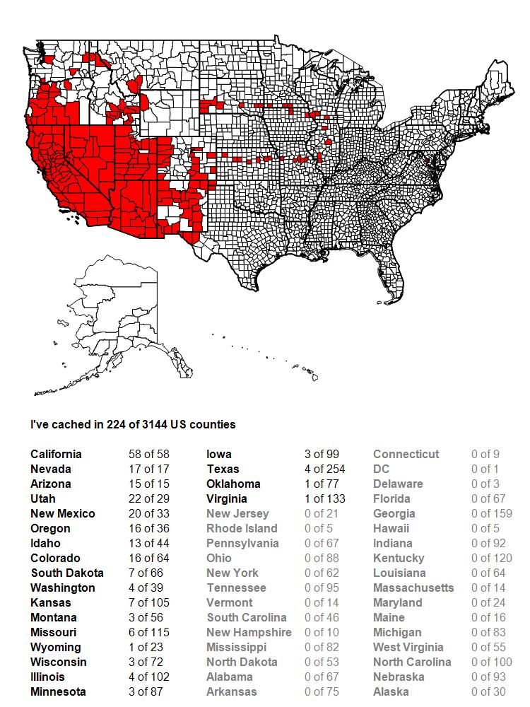
Challenge caches are just that; they challenge you to do something in order to claim the find on the challenge cache.  They can be as simple as find 25 geocaches, to finding a geocache that was hidden in every month since geocaching has been around, to all sorts of other options in between. I worked toward three different challenges on the second day as I drove to Potters Pond.  One was for 100 contiguous county finds.  Before this day, I'd found geocaches in 95 contiguous counties, so obviously, I needed 5 more counties connected to the ones I'd already found geocaches in to get me to 100.  By the end of the day, I'd be up to slightly over 100, so mission accomplished and by the end of the trip, I'd be up to 117 contiguous counties.

The second challenge I was working on was to find more caches above 8000 feet. This particular challenge, I haven't found yet, but it's on my "to do" list.  It's located up in the Sierra Nevada, above 8000 feet obviously, but it would also mean a hike along the Pacific Crest Trail, something that I want to do more of anyway.  It's on the back burner, but as long as I'm at altitude, I might as well get as many as possible.  I'm not sure how many I have at the moment, because it's more difficult to check (I'm on a Mac, so I don't have ready access to GSAK, a Windows based program for geocaching), but I found 12, possibly 13 more that were at over 8000 feet, so I added to the list.


The third challenge was getting Potters Pond. For the uninitiated in geocaching, the Jasmer Challenge challenges you to find a geocache that was placed in every month since geocaching started, way back in May 2000.  Yes, this means you have to find a cache that was hidden in May 2000, plus June 2000, etc., all the way to the current month.  Before this trip, I needed 3 more months, June, July and August 2000.  On my road trip two summers ago, I'd found the oldest geocache in the world, Mingo, so May 2000 was covered.  I'm also fortunate, since I started geocaching in March 2001, there were some of those older caches still around.  In fact, my very first cache find was hidden in December 2000, so I've never had to worry about that particular month.

August 2000 has always been kind of problematic, since there are only 3 geocaches in the entire United States that are still around that were hidden in that month, one in upper Michigan, one outside of Atlanta, Georgia and Potters Pond.  Potters Pond is also at altitude and under snow for probably half the year or so, so it's definitely a summertime grab.  So that became the focus of the day.

Potters Pond is located along a trail near a campground.  The tricky part is finding the correct trail.  Once you find the trail, it's a pretty easy maneuver to get back and find the cache.  I did my homework and when I arrived at the campground, I hiked back, found the correct trail, found a couple of other caches along the way, then walked back into the woods and eventually claimed the prize.  The one photo of the actual pond is what I have as proof that I was there, mainly because the mosquitos that day were horrendous.  As long as you kept moving, you were okay, but as soon as you stopped, they descended, as if they were vultures coming across road kill, even biting through my shirt.  Needless to say, I traded travel bugs quickly, signed the log quickly, replaced the cache quickly and got moving again.  But, I now have August 2000 off of my list and I'm only a road trip to northern Oregon away from completing the Jasmer, as there are caches still around up there from June and July 2000.

If you want hints on how to get there, which roads to take, don't hesitate to ask someone who's already found it.  Bushwhacking would take a lot out of you.  The trail leads right to it.  I listened and learned.