Showing posts with label Arizona. Show all posts

Sunday, March 2, 2025

Free For All!

I keep getting these notifications every month for P.J.'s Photo Blog challenge and when I took at my photos, I never seem to have anything that fit the theme. And thus I've been sitting on this blog for well over 6 months now, having not written a thing. However, the theme for this month is Free for All! Yeah, not only can I do that, I have quite a selection of photos to choose from so I may be hard pressed to get photos down to just five, but I will try my best. So here we go with my five photos falling into the category of Free for All.

1. Block Party

2025 is the 25th anniversary since Geocaching became a thing and so headquarters has come up with several ways to celebrate it, extending a rare type of cache known as a Block Party to all of the Mega Events happening this year. I've previously written about Mega Events several different times, but this post regarding the Mega Event that happens every February in Yuma, Arizona probably gives the best description of it.

This year's Yuma event was the first Block Party I've ever attended and it lived up to its billing. We drove out to Yuma on the Thursday before the event and basically for the next five days geocached. For the most part, it was a week long party with 600+ of my closest geocaching friends. I averaged finding close to 50 geocaches per day.  Needless to say, it was a lot of fun.

2. 25

Every now and then, Geocaching will introduce a limited edition Locationless Cache. These used to be quite popular when Geocaching first got started, but eventually, headquarters did away with them because they didn't feel like they fit in with the direction the hobby was headed. Now, they come back occasionally. The principle is simple; find something or do something that fits the theme of the locationless cache. In this case, this year's locationless theme is the number 25. What they want us to do is find a permanent number 25 somewhere out there, while we're geocaching and take a photo of it. Then we can log that particular cache. 

Originally, I had intended to head up in the central coast of California and get my photo with one of Hwy 25's highway markers. But I was exploring a cemetery in Quartzite, Arizona at the end of the Yuma Block Party and I came across Duane Bindewald, a sailor, born in 1925 and who probably was involved with World War II since he would have been the right age at the time. Once I saw his gravesite, I could think of no greater tribute than to memorialize him as my 25. Thank you for your service Mr. Bindewald.

3. Community Celebration Events

The third thing geocaching has brought back this year are the Community Celebration events. These are events put on by regular geocachers that bring our geocaching community together. You had to have hidden a geocache and also hosted a regular event last year and then you were qualified to host a Community Celebration event sometime over the course of this year.

I was awarded mine early on, mainly because I host events every month in our local community and I decided to host myself a birthday party, and so 67 on Route 66 was conceived. The event was held in a local Shakey's Pizza Parlor about 5 miles east of where I live and when I approached the manager back in January about reserving the place, he didn't hesitate. We blocked out the time and he asked an estimate of how many people were going to be there and at that time I had about 25 "Will Attends." Geocaching headquarters says when you're hosting an event to multiply the Will Attends by 1.6 and that will give you a fairly accurate head count. So I told the manager 40. 

Well, the will attends kept coming in and by the time of the party, I had 49 will attends, which if you're keeping up with your math skills translates out to about 75 actual bodies. And that's about how many showed up. We pretty much took over the place and Shakey's didn't even bat an eye. They were busy, but they were also getting a lot of business that they might not have gotten if I'd held the event in a nearby park instead. So it was a win/win situation all the way around.

There was lots of spirited geocaching conversations to go around and I don't believe I sat down at all as I moved from table to table. The photo is one of my geocaching friends and I. I chose this particular photo because we share the same birthday, so it seemed appropriate to have this photo of my birthday buddy.

4. The Tiny Human

While I'm having my birthday party, my daughter, son-in-law and granddaughter drove down to visit me for my birthday too. That weekend we ended up doing a lot of different things. I haven't written about this here on this blog, but I have posted things on Facebook, but my mom passed away last September and so this birthday was the first one I celebrated without her.  My daughter knows when I'm going to get "the feels" and she also knows that the best thing to get me over my big feelings is a visit from my tiny human.

We went down and visited my dad for one afternoon. We walked through the neighborhood and played on the nearby playgrounds. We picked oranges from the backyard trees and then enjoyed the fruits of our labor by drinking freshly squeezed orange juice. It was a very enjoyable visit and altogether too short, but I know I'm going to see them again later on this month, so I have that going for me. I always dismissed people who said that being a grandparent was the best. I understand thoroughly now and look forward to our nightly FaceTime videos as well as our visits north and their visits south. Being a Papa is the absolute best.

5. Spring is starting to spring

Even though it's only early March, you can start to feel spring in the air. I went for several hikes in the nearby hills this past week and the latest hike on the last day of the month I was rewarded by seeing a variety of wildlife. I saw my first two snakes of the season, both small gopher snakes and while out on a walk just in the neighborhood the day before I came across this beautiful Cooper's hawk taking a drink from the fountain in the front yard of this house.

It didn't take too kindly to me being right on the sidewalk, so it flew up to a branch of the nearby tree and just perched there. I admired it from the distance and then remembered to take a couple of photos of it, this one being one of the better ones.

And there you have it, my take on the Free for All theme for this month. Please feel free to stop by P.J.'s page and check out the other bloggers who post to this particular photo challenge. Please, also feel free to comment here. I won't bite.

On a side note, I'm hoping this will spur my interest in doing this again. I found another travel blog app that I've tried out that allows me to do travelogues in real time, but I'm not sure I'm comfortable allowing everyone on the planet seeing what I do in real time. Most of what goes on on those is a lot of geocaching and I know all of my audience here doesn't necessarily go for all the geocaching, so I'll probably continue to do that, but then synthesize those down into a feature here. I have several trips I have written about that I can post here, plus a couple of geocaching stories that I can throw into the mix as well.

Thank you for you patience during this long absence.

Friday, June 7, 2024

A Look into my Life

Well, once again, it's that time of the month where P.J. has his monthly photo blogging challenge. This month's theme is "A Look into my Life." I figuredwith the amount of photos I took this past month, I should be able to come up with five photos that sort of personify me.

1. Geocaching and travel

As you all know by now if you've been paying attention, I love to geocache. I also love to travel which works out well since they go hand in hand with each other. Last month I attended two geocaching Mega Events, one in the Los Angeles area (Spring Fling) and the second one which was in Flagstaff over Memorial Day weekend (GeoWoodstockXX). Both of the events were put on by the same individuals, so there was a lot to compare and contrast but if push came to shove, I'd say the GeoWoodstock was Spring Fling on steroids. It was just bigger and better all the way around and that's to take nothing away from the Spring Fling. 

Let's just say over the course of five days in Arizona, I got to see a lot, find a lot of geocaches and just have a really good time enjoying this crazy hobby that I've been doing for over 23 years. With the two events and other geocaching excursions I did this past month, I found 430 caches, which was my second best month ever. 

I've said in the past and I'll say it again here; geocaching takes me to places that I wouldn't necessarily visit were it not for geocaching. I mean, I got to stand on the corner in Winslow, Arizona while the store across the street played "Take it Easy" in a loop all day long. Unless you make it a point, a lot of these interesting tourist spots just get driven right by, but because I have an interest in travel and geocaching, I've gotten off the main highway and done some scenic byways that I might have missed otherwise. Watch the Pixar movie "Cars" and I think you'll understand perfectly.

2. Hiking

I also really enjoy hiking along all kinds of trails, but I have a big interest in longer trails, trails like the Pacific Crest Trail (PCT), the Continental Divide Trail (CDT) and the Arizona Trail (AZT) to name a few. I've hiked portions of all of these trails in my lifetime and while my age is starting to become a factor in how much backpacking I can actually do, I haven't ruled out the possibility of doing some section hikes on any of these trails. I've just become more accustomed to the finer things in life, like an actual bed to sleep in when I travel as opposed to a sleeping bag and sleeping pad on the ground.

While in Flagstaff, I was able to hike a portion of the AZT. Once again, geocaching was involved. We'd gone up to finish off a geocaching adventure up in the mountains north of Flagstaff and we'd noticed this cache just off the road at a turnout. We decided to find that cache after finishing off the Adventure stop and I am really glad we did. We pulled off at the trailhead, then took a side trail, which took us down to the AZT, which then took us up to the junction that led us out to the meadow you can see in the distance. Eventually, we found another side trail, which led us to the geocache we were looking for, one that had been hidden in July 2001. It's always cool to find caches that are 23 years old. As time goes on, these old caches are becoming rarer and rarer and so they become valuable in the game for different challenge caches out there that want you to find old caches.

3. Photography

If you're still reading along, you're probably noticing a theme for this entire entry, but you knew that was going to happen anyway, didn't you? Anyone who travels knows to bring a camera along to record their journeys and refresh their memories when they get back home and I'm no exception. 

This particular shot wasn't taken on any trip I took, but I happened to spy this ladybug right outside our community center about two blocks away from our house. I really loved the large amounts of yellow and green with that little splash of red thrown in which made for a very pleasing image in my opinion.

My photographs tend to lean heavily towards the natural side of the earth as opposed to the cultural side of things and so I have lots of landscape type photos in my galleries and photo albums. I will also tend to have lots of animal photos both large and small. Looking back on this blog entry however, I think I've actually achieved a good balance between nature and culture this time around. Sometimes that's just how it goes.

4. Food

When I'm out and about traveling, I tend to lean toward more local cuisine, especially when I'm eating at the dinner hour. This trip to Flagstaff last month was no exception. We had Mexican food, we had Neapolitan Pizza, and then we had some American comfort food in the form of this Texas burger with sweet potato fries and a stout chocolate porter. And yes, there's bacon in there too. Just looking at that photo makes my mouth water. This meal, for the most part, was the perfect ending night of that weekend.

Please also understand that for lunch I'll usually eat at a place that's tested and true for fast food, mainly because I have an agenda that I like to complete. We ate at In-n-Out for lunch one of the days on this trip. It was quick and easy and I can now say I've eaten at the highest elevated In-n-Out at just around 7000 feet above sea level. In fact, it's the only in-n-Out I've eaten at where they didn't have the crossed palm trees (a corporate symbol) out in front of the restaurant. It's just too cold for the palm trees to survive. So it's fast food for lunch but breakfast and dinner are really supposed to be savored when I'm traveling.

5. Family

I really couldn't go an entire blog entry about myself without talking about my family and particularly, this little gem. I found myself getting to hang out with my favorite tiny human in the middle of the month in Paso Robles so her parents could attend a wedding there. We got to hang out all weekend together, play in the park, go to a farmer's market and then enjoy each other's company in the evening while her parents were at the wedding.

I don't know if you've ever heard the sayings about being a grandparent, but everything you've heard is definitely true. Being this tiny human's Papa is one of the best things that has ever happened to me. We're fortunate enough that we live only a half day's drive away from them, so I get to see her on a regular basis. That, plus the technology of the day where we can FaceTime at meals really allows me to see her grow up. And yet I'm still amazed when I look back at videos from six months ago and see how much she's grown. Let's just leave it at, I'm really enjoying this part of my life.

And there you have it, my take on the theme "A Look into my Life." Please feel free to comment and check out the other entries to this month over at P.J. blog.

Monday, April 8, 2024

Which to believe?

Back in early February, I headed to Yuma for the Southwestern Arizona Geocachers annual mega event. Lots of fun was had all weekend long and our geocaching adventures took us all over the southwest corner of Arizona. At one point, we came across this benchmark on a canal overdressing. If you look closely, it's an elevation benchmark listing the elevation above sea level as 132.8 feet. I'm not sure when this benchmark was placed, but it was probably placed sometime in the middle of the last century.

When I saw it, I decided to get out my phone and pull up an app that I have on the phone called My Altitude. I've used it in the past and it's proven to be pretty accurate when comparing it to other spots of known elevation. One summer when camping in the eastern Sierras, my friends and I hiked up to the top of Kearsarge Pass out of Onion Valley. This pass tops out at 11,760 feet above sea level according to the sign indicating you're entering Kings Canyon National Park. When I pulled out the phone on that particular occasion the My Altitude app was within about 10 feet of the same numbers. Several other times I've noted that the app was very close to what was an already known altitude.

Which brings me back to this benchmark. I spotted this one and once again decided to see what the app said about the altitude on this bridge. As you can see, there's almost a 30 foot difference in elevation between the posted altitude and what was showing on the app. I have theory behind this which, I think, offers a possible explanation as to why the app was so different from the posted altitude.

Altitudes are constantly being changed and/or as better technology rolls on to the scene. When I was growing up, I remember Mt. Whitney, the highest peak in the contiguous United States measuring out at 14,495 feet above sea level. Yet today, if you look on new maps, you'll see that Mt. Whitney stands 14,505 feet above sea level. What? An earthquake happened and the mountain grew by ten feet? If that had happened, we'd know about it because that kind of earthquake would be common knowledge, especially in this day and age.

What's happened is, over the course of time, new technology has allowed us to measure things more accurately, hence the change in the elevation of Mt. Whitney and other peaks all over the world. Even Mt. Everest in the Himalayas is a different height than when it was when I was a kid. New technology has caused our measurements to be more accurate.

So if this benchmark was embedded into the bridge before the advent of satellites, which is entirely possible, we're looking at probably outdated information on the benchmark. Please notice on the My Altitude app that the elevation is accurate to plus or minus 11.09 feet. So the benchmark could be as high as 172 feet above sea level or possibly only 150 feet above sea level according to the app. Now if we extrapolate it out and say that technology might have added an additional ten feet in actual elevation to where the benchmark was located on the bridge, then we actually fall into the margin of error, especially if the app was measuring things a little bit too "tall" that particular day. 142 feet as opposed to 132 feet on the benchmark and the app could be as low as 150 feet, which means there's only a difference of 8 feet between the benchmark and the app, which is about what I've been seeing ever since I started using the app.

Granted, this is all hypothetical, but that's my best guess as to why the two were so far apart originally. I guess what I need to do is bring out the My Altitude app more often when I come across things that have a posted elevation so I can get more data.

So what are your thoughts on this? Do you think I'm close? Or do you have a different hypothesis of your own that you'd like to share? I'd love to hear your thoughts on this.

Tuesday, March 5, 2024

Exploration

It's the beginning of the month and although it's a little late, it's time for P.J.'s photo blogging challenge for the month of February. The theme this past month was Exploration. After looking at my photos that I took last month, the explore theme fell right into my lap and the tough part was picking the photos that I wanted to represent each exploration, but I narrowed them down to five and so here we go.  This is my take on the theme Exploration.

First off, I want everyone to know right now that most of this post will be about geocaching, so if you're not interested in geocaching, then feel free to stop at this point in time. All of the photos for this month's theme dealt with geocaching in one form or another, sort of.

1. Exploring Geology

The first weekend in February I took a road trip to southwestern Arizona, most particularly, Yuma, Arizona. The geocaching group down there hosts a large event on the Sunday and there's all sorts of things happening the entire weekend. One of the things I like to do when I'm on a road trip is to get as many different icons (geocaching types) as possible. One of the types that I found that weekend were five earth caches, where you learn about a geologic phenomenon of some kind, then answer some questions regarding what you've seen.

This particular earth cache is located just north of the town square in Yuma. We actually had a little time to kill before heading down to the town square for a flash mob event, so we stopped off here to study the rock and answer the questions put to us on the cache page. Most geologists that I know always carry a coin in their pockets so they can use it as a reference marker for grain size of a particular rock, hence the photo of the quarter on this rock. We ended up finding five different earth caches that weekend, not a large total, but it was enough for us with all of the other things that we explored that weekend.

2. Exploring History

One of the newer types of geocaches are the Adventures. They are kind of a cross between a multi cache and a virtual cache. We did quite a few Adventures on our way down to Yuma, mainly because it was raining all the way down there and the Adventures tend to work better, because you're looking for information, as opposed to an actual container and so you can usually get the answer much more quickly.

However, several of the Adventures that we'd chosen to do that day were quite moving and we ended up getting pretty wet in the process. One Adventure in Cathedral City had a stop at a Cancer Survivor's Park, which, for obvious reasons, was quite emotional for me. I chose not to post a photo for that one, mainly because I didn't feel a got any really good photos and so I opted to post this second photo instead.

This Adventure was in Palm Desert and explored a huge park in the city. One of the stops along the Adventure was the Desert Holocaust Memorial. This particular sculpture was right in the middle of the spot and I felt the sculptor caught the essence of the tragedy of this event. I hope I was able to convey with my photo what I felt the sculptor had already done.

3 & 4. Exploring Food

In our local geocaching community, I have a reputation of liking my food and I also have a reputation that when I say I'm hungry, that's usually the signal that we need to stop very soon and find a place to eat, otherwise "Webfoot" is going to get hangry. And hangry Webfoot is not a pleasant individual to be around. On this trip, I don't think I ever had to worry about being hangry, or even hungry because we ate well.

We were in the Palm Springs area on the first day and my daughter, when she heard that we were going to be going through Palm Springs, recommended Sherman's Deli and Bakery. The menu was extensive and I eventually settled on Sherman's Philly, with brisket, peppers, onions and provolone. Then of course, I almost had buyer's regret when I saw the man at the next table get served his Reuben sandwich. Man, that looked good, but once my sandwich came, I was all in. I guess what this really means is I need to go back there again to try the Reuben. Yeah, I can do that.

We had an asian buffet later that weekend and the last night we were there, we had fantastic Mexican food at this place that used to serve up from a Taco truck, but in the past year or so have found a brick and mortar building to serve great food. After we finished there, I mentioned that we really needed to go get some ice cream and so we ended up driving up to Mooos Creamery.

The wait was a little long, but the ice cream was worth the wait. My friend Kami had already decided when we walked into the place that she was going to sit on the ice cream bench as opposed to a booth, and so that's why we ended up there.The place had so many choices, that this is one of those places where you're going to have to go back more than once to really enjoy yourself. I had two different flavors and I could have probably chosen six or seven different ones; they all looked so good. Once we were totally satiated with that, as always, we checked our geocaching apps and realized there was a geocache right behind the building, so we walked out and around to the back of the building to score one more find before the night was done.

5. Exploring Geography

If you don't already know it, then I should tell you that I majored in Geography in college. I ended up taking a physical geography course while in community college and I was off and running from there. I'd found a subject that really interested me and I took more and more courses there and when I transferred to Humboldt State University, I continued to take courses in Geography pursuant to my degree.

I can honestly say that most of my hobbies revolve around geography in some way or another. I discovered Where's George? the dollar bill tracking web site. You enter your dollar bills, mark them in some way telling people to come to the website and then you spend your money in the hope that it will show up again. This hobby led me to Geocaching and although I still find Where's George? interesting, it's more of a passive type of hobby since you can't really control where your bills go.

Geocaching, on the other hand, you control what you do.  You want to go on a road trip to find geocaches? Go for it. You want to find urban micros? Go for it. I guess the point I'm trying to make is you can decide how your geocaching hobby works for you and that's why I like it so much more so than Where's George? I think that I like geocaching so much more because it involves all sorts of the different types of geography that I studied when I was in college, physical, historical, political, and many others.

Geography in general is a combination of different fields that sort of overlap. For instance in this last photo, we can see the physical geography of an area, what the lay of the land is doing and how those mountains in the background might be influenced by the river that you can't quite see behind me (that's an irrigation canal directly behind me). You can also see the political and human implications if you explore more deeply into this photo. I found this photo interesting from that point of view. Here I am, exploring my hobby of geocaching in Arizona, with California over my left shoulder and Mexico over my right shoulder.

And there you have it, my interpretation of the theme for this month Exploration. Please feel free to stop by P.J.'s blog and see how he and others interpreted the same theme. Please feel to comment here. I promise, I won't bite.


Wednesday, October 18, 2023

Road Trip!

This post is primarily dealing with geocaching, so if you're not interested, then you can probably stop reading right here. Things have settled down tremendously over the early part of the year where everything seemed to be upside down. In my last post which I published back in the early first week of August, I mentioned that one of my happy places was in planning road trips. This post is the first of several detailing the road trip I took to Colorado and Utah in the month of September.

The first two days of the trip were mostly traveling, getting to my first destination in Colorado, so it was primarily driving and taking breaks here and there for geocaching. Most of the geocaches that I wanted to find on this trip were either going to be virtual or challenge caches as those two were my primary focus. I would also be working on several challenge caches, including one that wanted me to find at least 6 different types of geocaches in 20 different counties. Since I had already done that in 19 different counties, I only needed one more, so I had a focus on Iron, Salt Lake, and Washington Counties in Utah, as well as Grand County in Colorado. My first night's stop was going to be in Cedar City, UT, located in Iron County, so that's where I figured I'd be able to complete that challenge.

I didn't end up getting what I needed in Iron County, since I couldn't find a particular cache near my motel, so I settled on other things that first night. One of the last caches that I ended up finding on the first day was a virtual cache in Cedar City that focused on the history of a fort that had been built there. In the morning I tried for a couple of other cache types nearby, but it just wasn't meant to be for Iron County and so I took off for Grand Junction, CO which would be my next stop.

Once again it was a full day's drive to get to Grand Junction, so there wasn't a lot of sight seeing involved, but mostly driving and stops to find geocaches. One of the stops that day involved a virtual cache which highlighted the first Olympic gold medal athlete of Utah, Alma Richards. I'm pretty sure that something like this probably wouldn't get approved in California, but I was surprised with this one since it took me literally onto the high school campus that Richards attended, onto the track, during the school day, while a physical education class was finishing up their running activity near the monument seen in the photo. No one said anything to me, no one questioned me as I walked on to campus. It was a little on the weird side to say the least since I'm used to schools being a little bit more security conscious when it comes to strangers walking onto any school campus. Anyway, I got the information I needed for the virtual and then quickly got off of campus and back on the road.

Another goal for the trip was to find at least one cache in each county I traveled through on the trip. This was a success as I only failed to find a cache in one county that I traveled through and ended up finding caches in 14 new counties. Yes, you guess it. I'd signed a challenge cache that wanted me to find caches in at least 200 counties. At the beginning of the trip, I was at 199, so Paiute County just off I-70 became my 200th county cached in and the first new one on the trip.

At a rest stop along I-70 was a great viewpoint called Spotted Wolf Canyon. There was a virtual cache here which I completed and then it was just a matter of stretching the legs a little bit. This particular canyon was amazing as it highlighted not only the view, but the engineering that went on to wind I-70 down through the canyon at a rather steep price back in the day. This spot also highlighted one of the main reasons why I've really come to enjoy geocaching so much. I've said it many times in the past, but it bears repeating. I probably would have missed this spot entirely were it not for geocaching. This silly little game has taken me to several spots that I never would have visited were it not for the game and that included spots in places like Yosemite Valley, that I felt I had explored extensively and there was no possible way that there would be something new to see in Yosemite. Geocaching proved me wrong there and it has continued to take me to awe inspiring and interesting places.

Finally, sometime further down the road that day, I ended up finding a traditional geocache. I actually found several traditionals during the day, but this one was intriguing in that when I signed it, about five signatures above it was another cacher's stamp who lives in the same area that I do. This is not the first time I've encountered things like this, but just the latest. The last time was when I encountered another local geocacher's name in a cache that I found in New Mexico. For the most part, geocachers love to travel, so this shouldn't be that surprising, but it's always cool to see friends' names in the log sheet that you've just signed.

That evening, I stopped in Grand Junction, CO which would be my base camp for the next three days or so. I did some caching in the area, actually bumped into a couple of local Grand Junction cachers who were looking for the same cache I was. When I'm on a road trip like this, I usually try to host an event somewhere just so I can meet the local geocachers. Grand Junction was no exception, so I asked them whether they were planning on attending my coffee event the next morning. They said they'd be there and then we ended up finding that cache, plus another cache nearby that had eluded them before. After finding that second cache, we said our goodbyes with the promise of seeing each other the next morning and I headed back to my motel to log my caches for the day and to get a good night's sleep. The next day promised to be a good sightseeing day for me as I was going to tour a nearby national monument, but I'll write about that in a future blog entry.

Thursday, March 2, 2023

Collections and traditions

For those of you who know me well, you already know that I'm most comfortable in tee-shirts and shorts, unless it's the winter months and then it's tee-shirts and pants. Not really much difference, but at least it keeps my legs warm.

Anyway, most, if not all of my tee-shirts are ones that I've purchased when I travel. I started this way back in high school when the family would camp in Yosemite National Park almost every summer. And every time I was there, I would purchase a Go Climb a Rock tee-shirt. It sort of became a thing for a while there and I had a Go Climb a Street shirt that I bought in San Francisco and a Go Climb a Volcano shirt that I purchased in Lassen Volcanic National Park. I even had a gag tee-shirt that a friend of mine purchased for me that said Go Climb Mt. Fuji.  

After high school, I tended to drift away from the Climb shirts and just purchased ones that I liked. Most of these tee-shirts center around the national park experiences, but there's also novelty tee-shirts that some of my family and friends have purchased for me. So what does this have to do with anything?

Well, when I'm out and about I tend to wear a tee-shirt that fits the theme of the day.  If I'm geocaching, then of course, the likelihood is I'll be wearing a geocaching tee-shirt.  If I'm camping, more than likely, I'll be wearing a national park shirt. Family visits usually mean I'm wearing a shirt given to me by one of my kids.  You get the idea now.

After looking over some of my more recents shots I took at several national parks, it seems like I have a "Go to" shirt for when I enter a national park and get my photo taken at the entrance sign of said national park. I'm wondering if it's my subconscious telling me that I have to wear my Yellowstone National Park tee-shirt every time I enter a national park, or if it's just a coincidence? It's probably the latter, but no matter what, since this has become sort of a tradition, I obviously will be wearing that tee-shirt on my next excursion out into a national park, or at least when I get my photo taken at the entry point sign. And of course, because I noticed this, I'm going to either have to get back to Yellowstone to get a couple more tee-shirts, or order some on-line so I have a ready supply for future trips.

Wednesday, March 2, 2022

Photographer's Choice

Four months. That's a long time between posts. In fact, it's the longest I've gone without writing anything here since this started back in June of 2019. Could I blame it on the fact that I haven't taken many photos over the last month? I could, but back in December, I took a lot of photos, but they didn't really meet the themes for the month, so I passed on even writing for the photo blogging challenge. Can I blame the new granddaughter? I could, but I won't. I wonder what I took photos of in December? Yeah, that's a no brainer, but I can't blame her so we'll just chalk it up to being lazy again. It's not like I don't have topics rattling around inside my head, but I just have been busy with other things.

So here we are at the beginning of another month and it's time once again for P.J.'s monthly photo blog challenge. This month, as the title suggests is Photographer's Choice, which means I can post just about anything I want that I've taken this past month. Fair warning right now, that this entire post is going to revolve around geocaching, so if you're not interested in that, feel free to move on.

This blog has always been dedicated to my wanderings and last month, I got to wander again, taking a geocaching trek to Yuma, Arizona. After a year hiatus (for obvious reasons), the annual SWAG (Southwestern Arizona Geocachers) mega event in Yuma was back. My friend Mike asked if I wanted to go with him and I said yes, since the last time I went two years ago, I had such a great time, I wanted to experience it again. I had a friend of mine from high school mention that he'd never seen the words "great time" and "Yuma" ever used in the same sentence. If you're a geocacher, you'd understand perfectly as it's kind of a geocaching Mecca for the area. And so we went, geocaching in Imperial County and Yuma County in Arizona for the entire four days we were out there. 
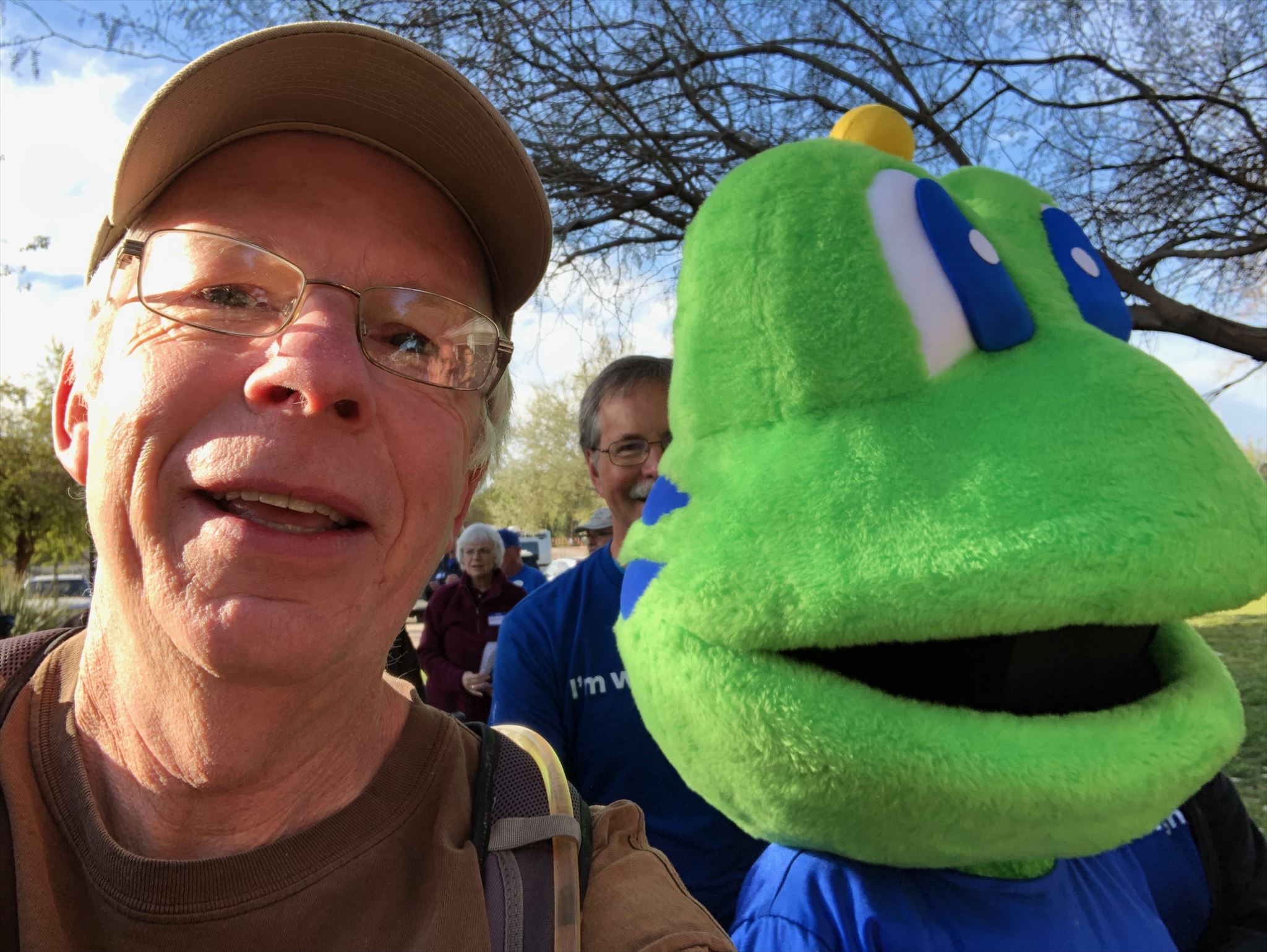
Part of the fun of the event is the new Adventures they post. As explained in other posts, an Adventure is similar to a virtual cache, except it also similar to a multi-cache, meaning it has more than one point to visit, but you don't have a container to find. The first photo was part of an Adventure in southeastern Imperial county and was called the Araz Station ruins. It was reportedly a stop on the Butterfield Stage route, but there's some debate over that. Nevertheless, we were there at sunset on the first day of the trip and the light made for some great shots.

Over the course of the weekend, we had some great food, found a lot of great caches and did some fantastic Adventures. We also experienced the Discover Yuma event, which is like a large geocaching scavenger hunt for information about Yuma and the surrounding area. Once complete, you bring your scoresheet back and you get a free geocoin, which is a tangible souvenir of the day's events. Mike had never done the Discover Yuma series before, so this was new to him and I did it last time I was there. It made for an enjoyable day on Saturday.

The second shot is of Mike and I in front of the log for the Mega Event which happened on Sunday morning. We did some hiking that morning picking up some more Adventure locations and found some other geocaches, then decided to do more caching in and around town as there's lots to do if you're a geocacher.

On Monday, we headed for home, but did a lot of caching on the way home. I even hosted an event in El Centro at the In-n-Out there as a way to attend an event in that county. There are challenges out there that want you to attend events in 10 contiguous counties. With that event, I now have attended events in 11 contiguous counties. Now I just need to go out and find that challenge so I can claim it. And with all of the caches we found in Imperial County that weekend, I bumped my overall count of finds there to 131, allowing me to claim the 10/100 California County Challenge. Yeah, find at least 100 caches in 10 different California counties. So I had that going for me as well by the end of the trip. Needless to say, it was a great weekend of geocaching.

The month wasn't over yet and geocaching was still a priority for me as I went on several other geocaching excursions over the next couple of weekends. One trip took me up to the high desert north of Victorville where we did a geo-art (caches laid out in the shape of something, like a smiley face). This particular series was called the Orion Series, because it was set up out in the desert to look like the constellation Orion. The best word I could use to describe many of the cache hides is whimsical. It's not often when you're looking for a cache and the cache ends up looking back at you.

But, part of the fun of geocaching besides finding them, is hiding them. So later in the month, I went on a hiding spree, hiding 6 new caches for people to find. The caches have all been found once and I believe there's a hiking group going out tomorrow to find these caches, which I hid in the wilderness park north of my house.

The fourth photo was taken near one of the cache hides. I called the hide 6 Posts for obvious reasons and it's by far, one of my favorite shots I've taken in the last couple of months. You'd think that a photo of 6 posts in the ground wouldn't do much, but I got very lucky with lighting and with the cloud cover that day to get, what I think anyway, is an extraordinary photo. If you look closely, the horizon is actually the Pacific Ocean, probably 40 miles away. It was a gorgeous day, considering I live in the Los Angeles Basin and we're not always so lucky to get such distant views.

Lastly, I've been upping my hiking this month as well. Midway through the month, I got my permit for a backpacking trip up into the Sierra Nevada at Cottonwood Lakes for August. I went last year, but we cut it short due to various circumstances, so I've started hiking more miles each and every day thus far to get my stamina up and to get my legs in shape. When the weather warms up, I'll start hiking at higher elevation as well. 

I took this shot a couple of days ago while out on a hike in the Marshall Canyon area, which is located just to the west of the Claremont Wilderness Park. In fact, the trails link up at the back side and you share some of the same trails if you hike the Marshall Canyon trail. The wild sunflowers are just starting to grow and bloom again and I thought the background of the canyon and the cloud filled sky to the east was perfect. As it is, this view today would look vastly different as there is now a huge plume of smoke from a wildfire that started burning today in about the same direction as this photo was taken. Fortunately, we supposed to get some rain over the next couple of days, so maybe it will be tamped out fairly quickly.

And there you have it, my five photos for P.J.'s photo challenge for this month. Please stop by his page to see how others interpreted the theme for this month.


Monday, November 1, 2021

Get Out and Play


Once again, it's time for P.J.'s monthly photo blog challenge, and once again, I've been remiss in not writing more here since this is literally the first post in over a month. I missed all of October, but then again, I could argue that I was following the theme of the month, which is Get Out and Play. Yeah, that's my story and I'm sticking with it. Needless to say, I went out and played this month, taking my first out of state road trip since before the pandemic hit. I hiked, I camped, I took lots of photos, so it was difficult to whittle down all the photos I took into just five shots, but I tried my best. Here are my five shots for this month.

1. A unique icon

Those of you who have been following along on this wandering that I do, know I love to geocache. One of the things that has kept me interested in the game are challenge caches - a cache that gives you a challenge to fulfill. 

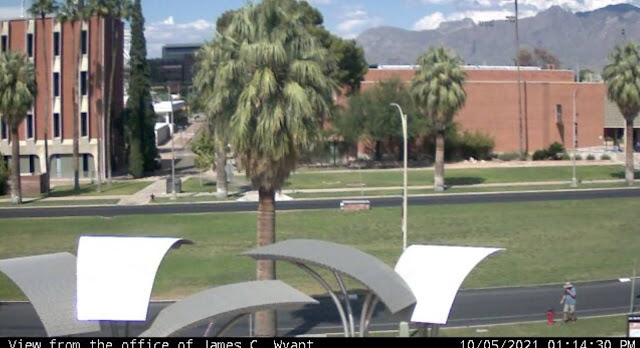
My first stop in Arizona was the Tucson area for two reasons: 1. Saguaro National Park, a place I'd never visited before and 2. The only webcam in the entire state of Arizona. Now, I know what you're probably thinking. "There's only one webcam in the entire state?" Well, there's only one webcam that's also a geocache in the entire state and it's located on the campus of the University of Arizona. So I ended up walking around campus that first day, looking for the webcam. Now usually, you'd just go to the coordinates and find the cache, but this one was a little bit trickier than that. You were told what building you needed to find, but the coordinates weren't at that particular building, but rather near a campus directory. Eventually I made my way over to where the webcam was and took a screenshot on my phone of me looking like I'm having a conversation with a fire hydrant on the university's campus.

On a side note, before smart phones, these were event tougher, because you literally had to phone a friend and have them get a screenshot on their computer. I did that here as a back up in case I wasn't able to get my own shot, but for this blog entry, I'm using my own photo. And this also gave me my 9th different icon, or type of geocache, in the state of Arizona, second only to California.

2 & 3. Saguaros

As noted above, the national park was one of my "must see" stops on my road trip to Arizona. I'm a national park enthusiast and this particular park has been on my bucket list forever. When we used to travel to Arizona to visit my uncle who lived in Scottsdale we never got as far as Tucson, but we could see saguaro cactus pretty much everywhere on the drive over to my uncle's house. They are fascinating and so the park which was a national monument at the time went on my bucket list. 

I never got to take the kids to see the park when they were growing up mainly because there's no car camping in the park, only backcountry camping. And so it sat there on my list until this past month when I decided that it was time.

I had plans to hike to a virtual geocache in the park, but the road leading up to that particular trailhead was closed while I was there, so I spent part of the morning walking a short nature trail in the park and the rest of the morning hiking on a trail in Tucson Mountain Park which is located to the east of the western portion of Saguaro National Park. The National Park is broken into two different sections, one located to the east of Tucson and one located to the west. The black and white photo, which I've entitled "The Clouds Laugh" was taken in Tucson Mountain Park while I was hiking and finding a couple of geocaches.

4 & 5. Chiricahua National Monument

My second stop on this trip was in Chiricahua National Monument in southeastern Arizona. The backstory for this park comes from a student I had probably 18 years ago. When I was teaching, my school room was always plastered with posters from various parks that I had visited or wanted to visit in the future. One day in class, this student came up to me and asked if I'd ever been to Chiricahua National Monument before. When I answered in the negative, he proceeded to tell me how beautiful the park was and what a neat place it was and he spent the better part of several class periods extolling the virtues of this park. When a 13 year old kid is that excited about something in nature, you pay attention and so this park went on my bucket list as well.

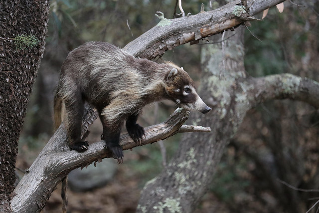
My plan was to camp here for two nights and enjoy a full day of hiking and sightseeing in the park, before heading back to Phoenix where I'd spent one more night before coming home. As I was setting up my tent at my campsite, I was interrupted by a couple of coatimundis wandering through the campground. I'd seen photos of them, but have never seen them in the wild, so this was really a thrill for me. 

These two were very skittish and took off as soon as I walked a little bit closer, so I didn't get a photos of them, but my luck definitely changed the next day as I had an entire troop of around 15 coatis wander through the river bed behind my campsite.

The troop, composed of females and youngsters wandered in the river bed and fortunately, I had my camera ready, just in case. They'd send the younger coatis up the juniper trees to pick berries and while feeding themselves up in the tree, they'd also drop berries down to the others waiting below.

Once they left, I packed up my gear and headed up to the top of the park where I'd take my hike in the Heart of the Rocks loop. My goal was to see some of the geological features of the park up close and to also get the Heart of the Rocks virtual cache there. The last photo posted here is the Pinnacle Balanced Rock and is pretty typical of the types of formations you can see in this park. 

Most of the formations are created by freeze and thaw cycles, so eventually, this particular formation will fail, but others will eventually also be created through this cycle as well. I did a second hike into an area called the grottos where the rock pillars are very close to the trail and several of the pillars have collapsed against each other. There is one point in the grotto where you can sit directly underneath a very large (garage sized) boulder being held in place by two neighboring pillars. Yeah, I sat there for a little bit.

And there you have my five photos of when I got out and played last month. Please stop by P.J.'s site and see how others got out and played last month. Please feel free to comment here. I will respond back and I don't bite. As always, thanks for dropping by.

Thursday, September 16, 2021

Standin' on the Corner...

Well I'm a standing on the corner in Winslow, Arizona, and such a fine sight to see. It's a girl, my lord, in a flatbed Ford, slowin' down to take a look at me.

And this marks the last entry chronicling the road trip my youngest and I took to Wisconsin and back. After touring through Petrified Forest National Park, we headed to Winslow, Arizona to spend the night. Of course we geocached around town that evening including finding a virtual geocache at this spot. Memorialized in song by the Eagles, Winslow has embraced the pop culture references with a statue standing on the corner and a painting in the background making it look like there's a girl in a flatbed Ford slowing down. The building that the statue is facing plays Eagles music most of the day, although I'm not sure how late into the night the music plays. But then again, unless you really hate the Eagles, does it really matter?

Either way, it's a fun spot when you find yourself in Winslow on Route 66. The following morning, we got up, drove into Flagstaff where we had breakfast, then headed home after a very fun road trip.


Tuesday, August 10, 2021

Petrified Forest National Monument

Once again, it's time to look back on my youngest and my 2017 road trip to Wisconsin and back. When last we checked, we had stopped at Capulin Volcano National Monument in northeast New Mexico. The following morning, we headed off with the intention of making it into Arizona, somewhere near Petrified Forest National Park. As we drove we, of course, geocached along the way, because that's what we do.

We stopped for lunch in Albuquerque, New Mexico and then continued on to Arizona, reaching Petrified Forest sometime around 3 o'clock in the afternoon, which gave us plenty of time to tour the park. This was my second visit to the park and the first for my youngest. For those of you unfamiliar with the park, you can either enter the park at the southern end or at the northern along Interstate 40. There is no established camping in the park but there is plenty of wilderness backpacking opportunities, although you'd have to be prepared since it is a desert and water is scarce.
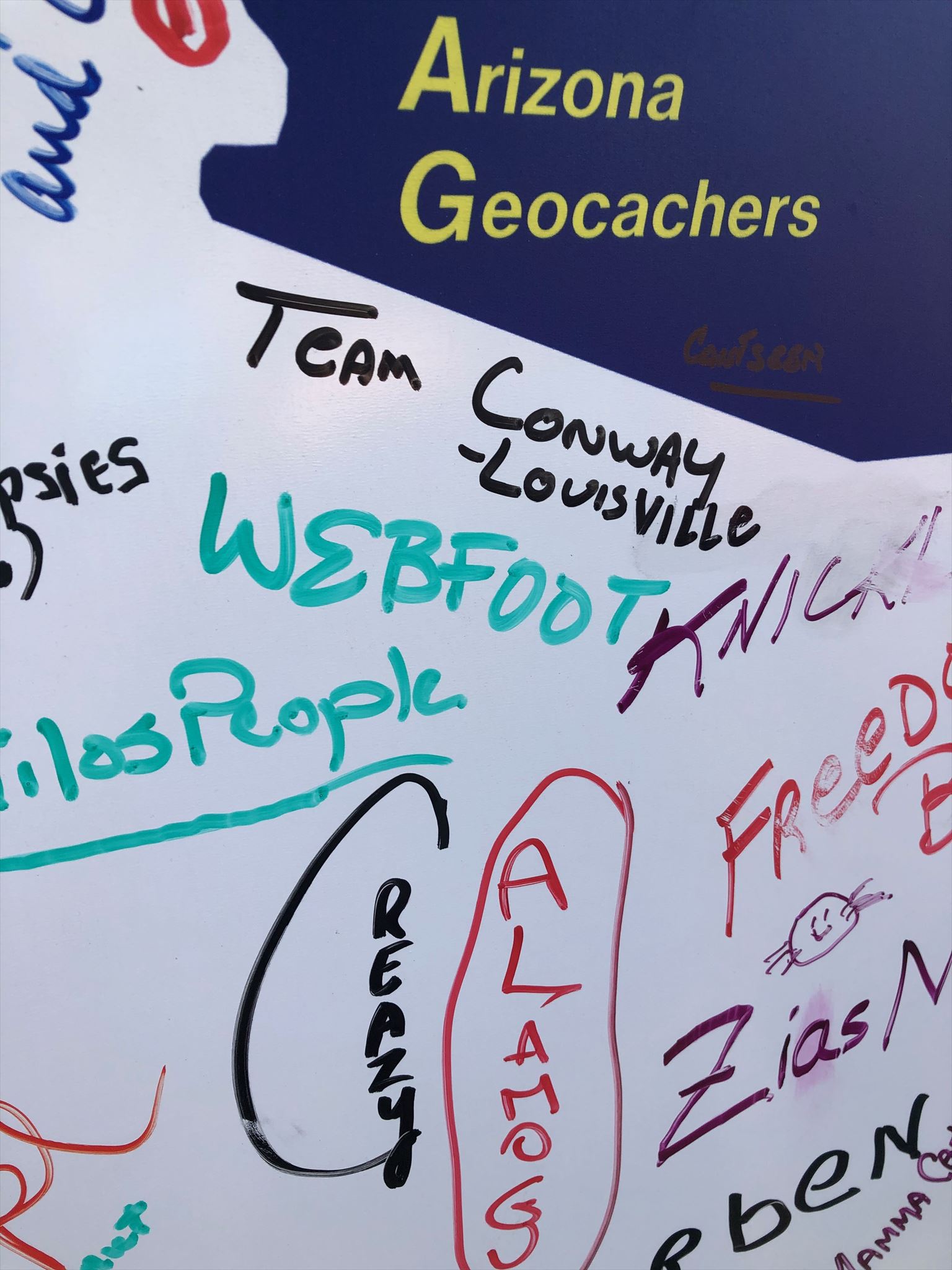
The park, for the most park is a drive through, something that can be seen in a couple of hours, but that doesn't diminish it in any way as a national park. The scenery is breathtaking with broad vistas in the northern part of the park. The small loop hikes take place in the southern part of the park where the concentration of petrified wood is found There's even several geocaches located within the park boundaries, which is very rare since the National Park Service views most geocaches as litter, but since these were all placed by a ranger who was stationed in the park, the park service allowed these. They even have a page dedicated to geocaching on their website. For the most part they were simple hides, but they took you to many viewpoints and points of interest within the park, without impacting the landscape in any way. Besides the traditional caches, we also found a couple of virtual caches and a couple of geological based earth caches.

Looking at the second shot, you can see in the distance, a developing thunderstorm. This would curtail a little bit of what we wanted to do, but we still were able to enjoy the park and what it had to offer. We drove through the painted desert part (northern) and stopped at all of the viewpoints, including one where there was a rusted hulk of a very old Studebacker roadster where there is a geocache hidden. Petrified Forest also has the distinction of being the only national park that the original Route 66 crosses through, which is what this viewpoint was pointing out.

After that viewpoint, you then cross over Interstate 40 and are now in the petrified forest. At every viewpoint, you get glimpses of logs, petrified with beautiful colors. As you can see in the third pooh  the colors of all of the logs were simply amazing. According to the park's website, the colors primarily come from three different minerals. "Pure quartz is white, manganese oxides form blue, purple, black, and brown, and iron oxides provide hues from yellow through red to brown." Most of the logs during this point are farther away, but you can walk out to them. Being in the high 90s, we opted to take photos and then continued on our drive, hoping to hike the Crystal Forest loop trail.

Once we got down to the Crystal Forest, we stopped and decided to hike the loop which takes you through a large portion of petrified wood and brings you very close to a lot of the logs that are preserved in the park. The temperature had cooled down considerably at this point owing to the impending thunderstorm which was approaching from the east. We kept hearing thunder in the distance and occasionally would see flashes of lightning, so we quickened our pace just a little bit. There's not a lot of cover out in the desert so the threat of a lightning strike was slightly higher, not to mention the distinct possibility that we could get rained on by a cloudburst.

I took some more photos and we finished up the loop and hurried back to our car, getting there just about the time it had started to rain. You can see the rain in the distance of the last photo as we hiked the Crystal Forest loop trail. As we walked the loop, I was struck by the immenseness of the logs, many like the one in the last photo lining the edge of the trail. I also lamented the fact that there had to be signs along the trail at regular intervals telling people that it was against the law to remove any of the petrified rock. In fact, people were encouraged to report other people who had removed pieces of petrified rock from the area. As you can see from the last photo, there's a lot of petrified wood, but if everyone took a piece every time they visited, the park would soon not have any of its namesake to even be a park anymore. If you are out and about anywhere, please practice the Leave No Trace principles as outlined on the link provided.

As noted above, you can probably see the entire park in about a couple of hours. To really delve into some of the trails, it would probably be more like four or five hours. But if you're traveling on Interstate 40, in the eastern part of the state and you're not in a hurry, this is a spot that you'll probably enjoy. I've been back a second time in October of 2019 when I was coming back from my Colorado road trip. I mainly stopped that time to find some of the geocaches that we hadn't found on the previous road trip mainly because it was really hot the day we were there. In October, I didn't have worry about heat and I was able to find the ones we'd bypassed two years previously.

Monday, March 2, 2020

Yuma

This is a geocaching article, so if you're not interested in that silly hobby of mine, you can stop reading now. I won't be offended in the least. It's been almost a month since the Yuma Mega Event at the beginning of last month and I really need to write about it.

The Yuma Mega Event is hosted each year by the South Western Arizona Geocachers (S*W*A*G). This was the 17th annual and the first one I've been able to attend. It's never fallen on a good weekend to go and half the fun is getting there and driving home and all of the caching that you do on the three or four or five days, depending upon how long you stay. This time, we left early Friday morning and got home late in the afternoon on Sunday.

A synopsis of the weekend would be as follows:  We did a lot of caching, and I do mean, a lot. There are events happening all weekend and because the S*W*A*G group has been doing this for awhile, it's a pretty well oiled machine with regards to organization. New caches popped up all weekend, giving many people opportunities for first to finds, if they wanted to go that route.

We opted to just cache in the desert on the way to Yuma, stopping here and there on the east side of the Salton Sea. Once we got into Yuma, we checked out the park where the Mega Event was going to happen and also found a couple of caches that had been placed earlier in the day. There was a flash mob event later in the evening that was a lot of fun and then we started working on some of the Adventure Labs that had been placed in and around the city.

For those of you who aren't familiar with Adventure Labs, they are a new cache type that can best be described as virtual multi-caches. You need to visit an area and get information that you input into the Adventure Lab app which will score you a cache find. Because there's nothing to find, it's more like a virtual cache, but it comes in groups of five or ten places to visit, so you literally get credit for 10 cache finds if you find all of the locations from a particular Adventure Lab. In the second photo, we were looking for a particular Adventure Lab Location. The Adventure Labs kept us busy until nightfall and then we found a great Mexican restaurant and had dinner.

The next day was devoted to the Discover Yuma series where we raced around on a scavenger hunt, finding clues and new caches all in the pursuit of Discover Yuma Geocoins. We finished the Discover Yuma series around 1:30 in the afternoon, then hit the power trails out in the desert. Power trails are just that, usually dirt roads where there are caches hidden approximately every 528 feet, the minimum distance needed between geocaches. It's a great way to bump your numbers up while having fun with a group of people. And we did both. 

Another event that evening, followed by some more caching, more eating of Mexican food, finishing up the Adventure Labs which we didn't get the day before. and finally crashing for the night.

Sunday morning, it was time to head out to the Mega Event. A Mega event is one where there are at least 500 cachers attending. Lots of people, but the park was big enough and they had one more Adventure Lab in the park that it didn't appear to be that crowded, because everyone was spread out. We participated in the Poker Run. I got two pair, but nothing worth writing home about since the winning hand as a full house I believe. Geocaching venders were there, Signal the frog, the mascot for the Geocaching website was there, so I scored a location less cache for the trip as well. 

Locationless caches were all the rage back in the early days of geocaching, but they were shuttered. Locationless caches had you find something of interest that no other geocacher had already found. For example, one location less cache I found was about Presidential Statues. I "found" the statue of William McKinley in downtown Arcata, California. Once I found it, that meant that no one else could find that particular Presidential statue. Other geocachers would have to find their own. I liked location less caches because it made me more aware of my environment. I kept a half a dozen location less caches in the back of my mind. Once I found one, I'd add another one to the mix. All in all, I found 25 before they were shuttered. Because geocaching is celebrating its 20th anniversary this year, they brought back the location less for this year. Signal was going to be at several Mega Events all around the world and all you had to do was get a photo of you with him to get credit for a find. And so I did. As of this moment, Signal has been logged 3724 times. I'm sure that by the time I publish this article, that number might be larger.

The event went on all morning and afternoon, but once we'd accomplished what we came to do, we decided that we wanted to beat the traffic out of town and headed for home, caching obviously on the way home. 

I'd heard stories of what a good time everyone had and I definitely wasn't disappointed with great expectations. It lived up to everything it had been billed by some of my friends and it's something I'm looking forward to going to again next year. There's literally so much to do out here that you could spend a week participating in everything and just scratch the surface. I think I actually need to go back there at a different time, perhaps in November when it cools down after summer and just cache in the some of the areas to the east of town. I've signed a challenge cache that wants me to find 1000 caches in two different states. Most of my 16,000+ finds are in California. This area could get me up to 1000 finds in Arizona very quickly.